I didn’t know anyone living in the Eastern Sierra when moving here. Looking for some likeminded people with similar ambition, I came across the Eastern Sierra chapter of the American Alpine Club. The closest I get to climbing are scrambles up class 3 and light class 4. Not a fan of carrying a rack of gear.
Despite that, I stopped by for an evening when a lead from Mono County Search and Rescue was giving a talk about their past year.
I arrived in Mammoth early, and realized it was hosted in someone’s backyard. I went up to a group of people, and the first person I started talking to was Ethan.
Some of my highlights from my first summer season have been with Ethan, specifically the run around Mono Lake, a middle-of-the-night run up one of California’s 14,000ft peaks to coincide with the blue moon, and more recently a nice long run from Tuolumne to June. Some fun, locally-sized epics.
Below is a recap of a recent trip Ethan took—the Sierra High Route.
Jon-Kyle: Ethan, what’s up? It sounds like there was some excitement recently along the Sierra High Route. What was your motivation?
Ethan: The Sierra High Route is really just an extended version of how I like to play in the sierra. It’s so good for scrambling cross country and some of the most unexpected and beautiful terrain is accessed this way.
Why just go out for a day when we could go out for a week or two?
Totally. I downloaded the Skurka maps years ago and every once in a while revisit them. It gets you into some really interesting terrain.
So what was your plan going into it?
Honestly I’ve had a really busy summer so I didn’t have too much of a plan going into it. My adventure partner Lucas idealized the route and I kind of just prepped myself physically for two weeks of rambling.
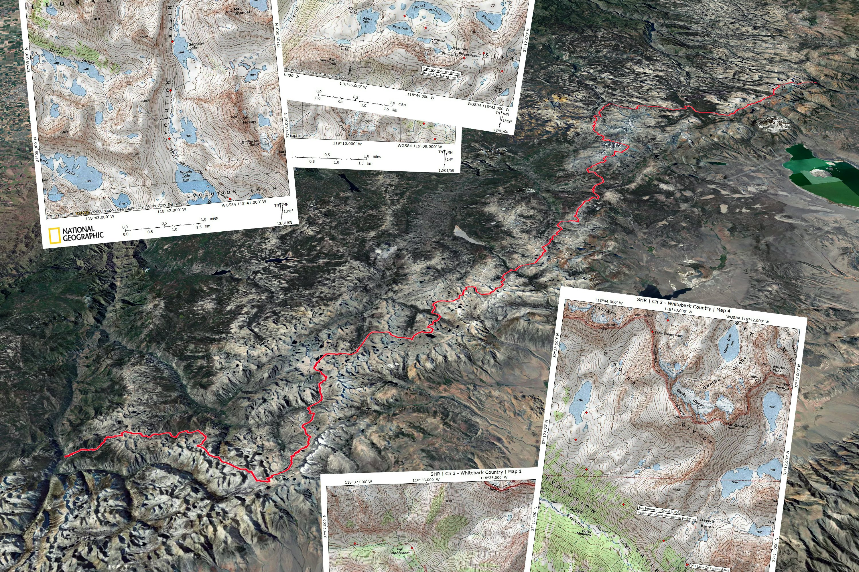
As far as the route goes, we jokingly called it the Extended Extended High High Route. The idea was to hike the entire length of the High Sierra. The traditional Sierra High Route put together by Skurka goes from Road’s End in SEKI to Twin Lakes in Bridgeport. We started at Sonora Pass and were hoping to finish at Cottonwood Meadows below Mt. Whitney. About a 280 mile, mostly off trail journey.
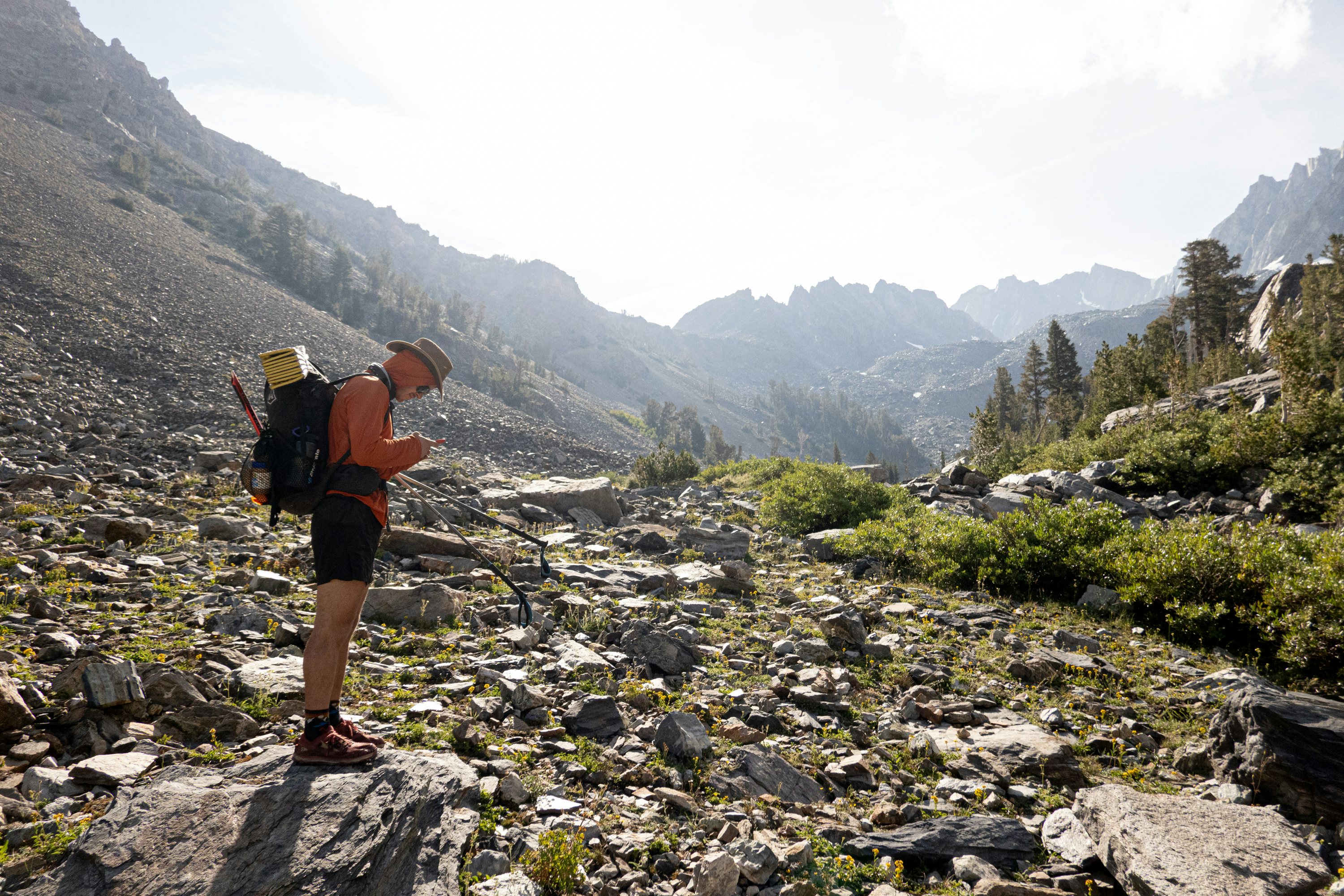
Yeah, definitely worth pointing out this is a route—not a trail. So there is a lot of navigation happening, and the terrain is anything but cruisy. So you start… how were the first few days?
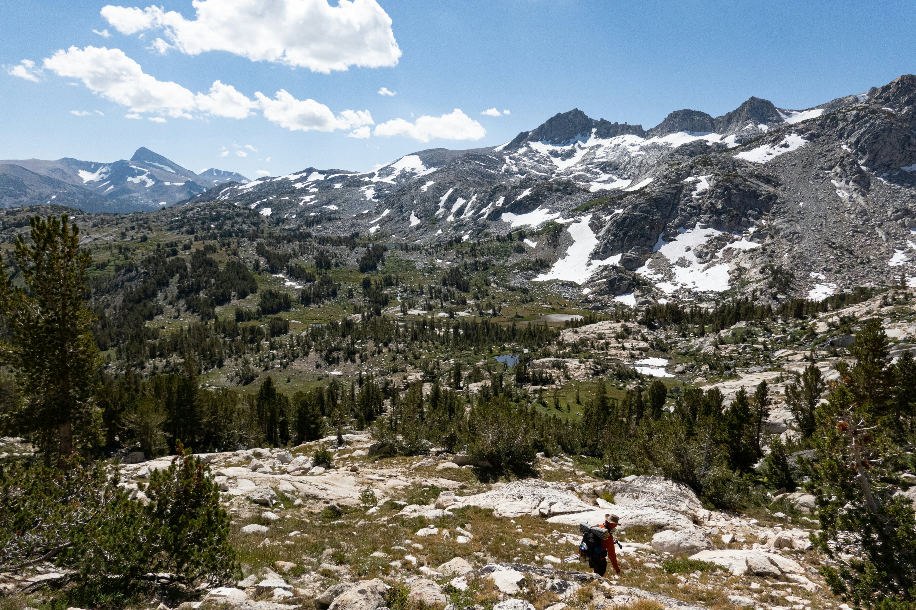
The first few were really hard and simultaneously some of the most beautiful days i’ve spent in the Sierra. We hiked from Twin Lakes in Bridgeport to Mammoth in 4 days. Each day was 15-20 miles of mostly cross country hiking and we gained and lost 5k-7k feet in elevation every day.
The word we used was “mega”. I remarked to Lucas on day 3 that my legs felt like ballistics gel. It became very important to get good sleep and eat enough if the next day was to be survived, haha.
That said, the terrain along the SHR between Bridgeport and Mammoth Lakes has got to be the most remote, beautiful backcountry i’ve ever seen in my 18 years of backpacking in the Sierra.
I’m finding the same thing; the place is continually unfolding, there are so many pockets. Gel legs reminds me of that “going to the store” video where this crash test dummy is rag-dolling down the sidewalk. Same feeling.
How was the break in Mammoth, and how were things feeling getting back out there?
The stop in mammoth was really fun and much needed. We went really hard those first few days in part, for better or for worse, because some friends of ours were having a pizza party and we didn’t want to miss it. So we hiked long days to arrive on time. We planned on just staying the night and leaving late the next day but a storm rolled in and we decided to take the whole day off. I ate my weight in pizza and drank my volume in cheap beer.
Ha!! Food is always the ultimate motivator.
Getting back out there with two nights of solid rest felt strange mostly because it was our first day on trail. We had calibrated our mileage for off trail travel and due to the trail miles landed at our target by 5pm, about 2 or 3 hours earlier than we usually stopped.
That day back felt lazy and relaxed. It was really nice.
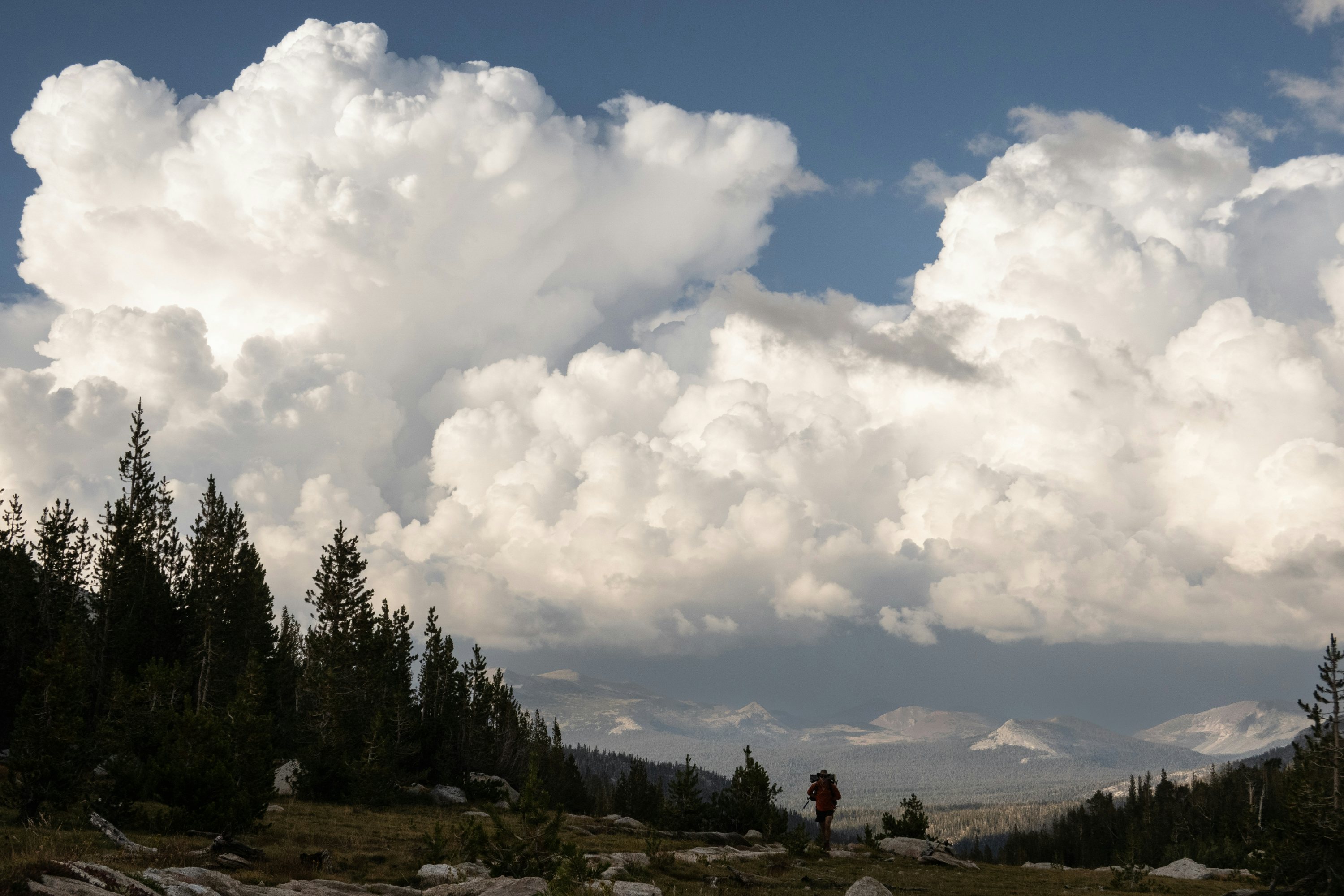
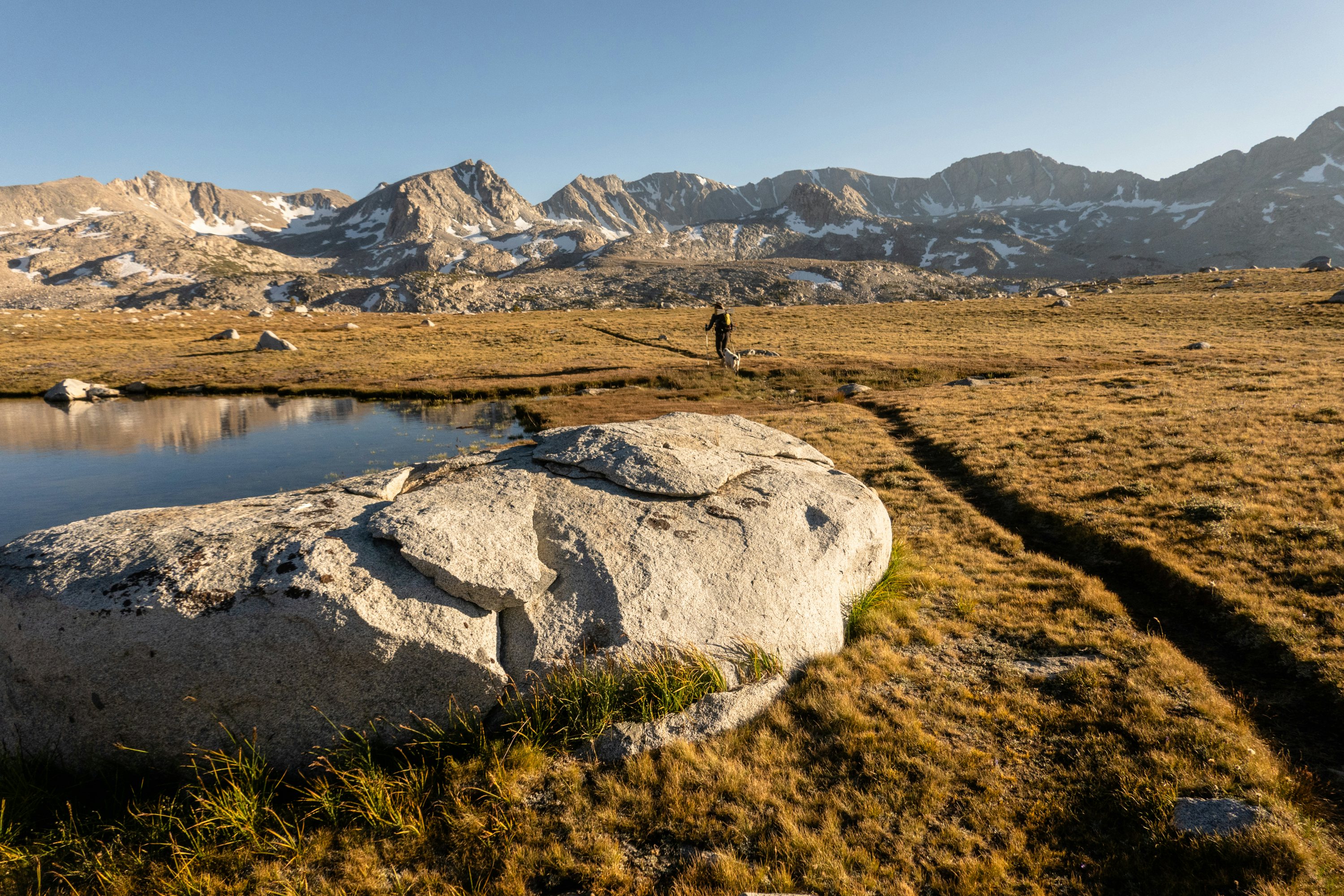
Always nice to break it up, although I tend to fall victim to the town vortex if I stay for too long, ha! What was your expectation for this next stretch? The zone between Mammoth and Whitney is pretty remarkable—and it’s not what you see when sticking on the trail superhighways along the PCT/JMT.
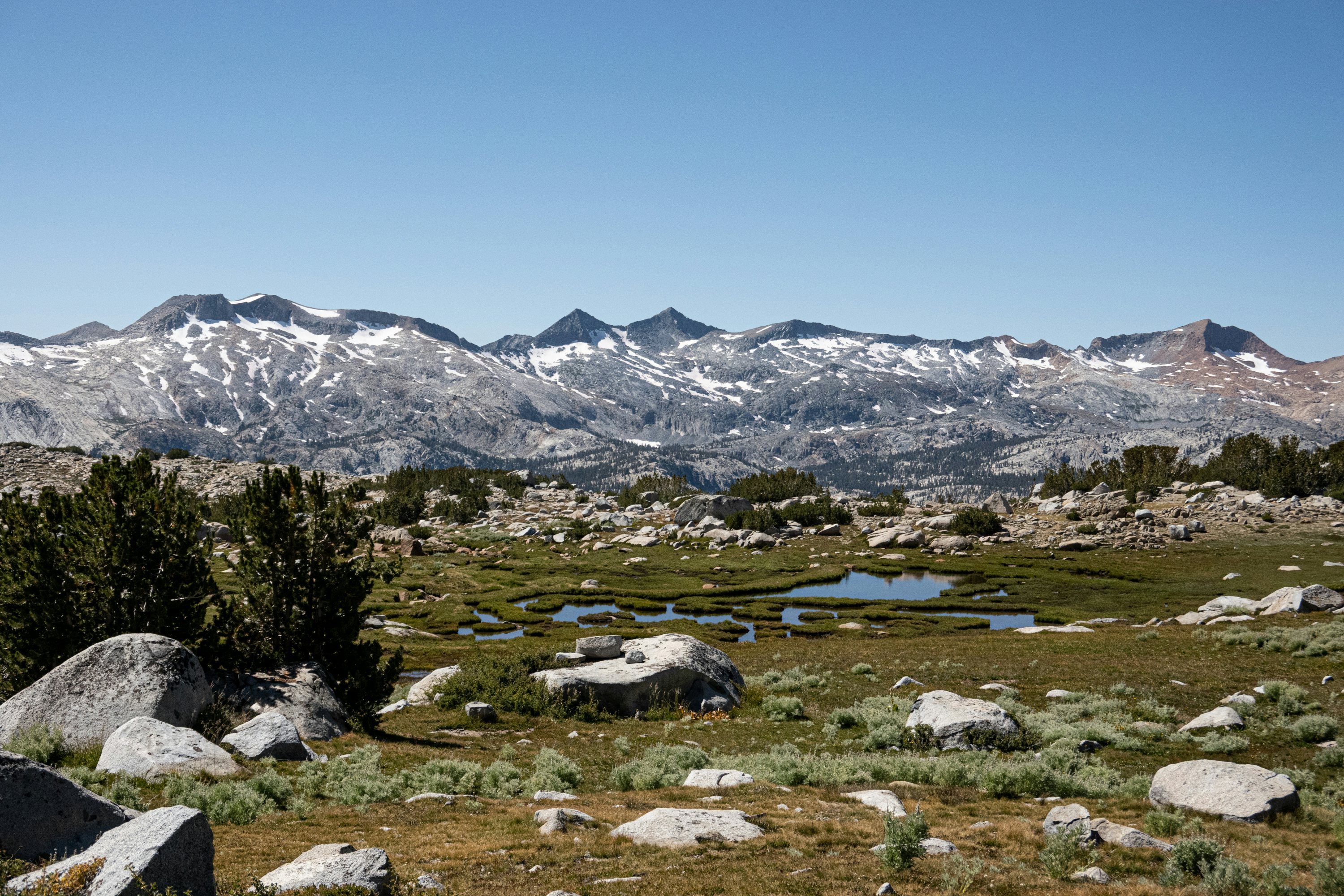
I wasn’t sure what to expect. I had been through most of these areas but always on trail. Sometimes i’d venture off into some trackless basin to climb a peak but would largely come back the same way. It was really fun to connect these larger basins by foot. Fill in that mental map of how the wilderness all comes together. Lake Italy Basin, Bear Basin, La Salle, Desolation basin, the Evolution valley, Dusy basin—what a stacked lineup!
Most of the terrain was new to me, some of it I had only seen once.
And this was the one section in wilderness which legally allows dogs. So we brought Lucas’ dog Spot. He was such a fun off trail companion. I know people have a lot to say about bringing dogs into the wilderness but whatever. He is the ultimate ultralight traveler. He has no shoes, has two built-in coats which he soaks when he gets hot. Eats cold, dehydrated, protein rich food twice a day. Drinks without filtering. And he’s a natural predator in these ecosystems. He chases all of the squirrels and marmots and birds. Thankfully he’s an idiot and can’t get them.
But having him with us, we got to hear this audible warning system echo around us every time we entered a wood or a basin. The animals were all communicating.
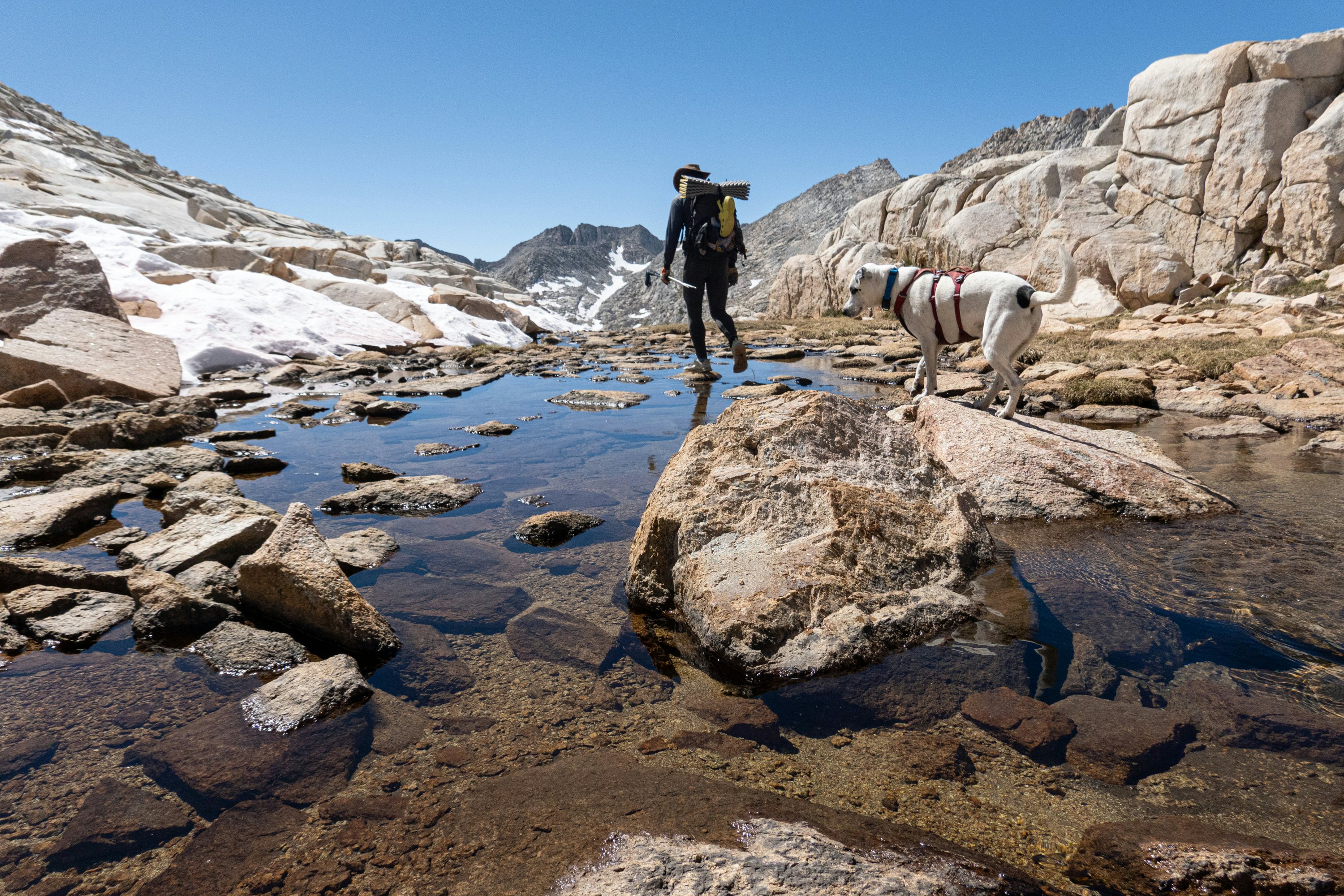
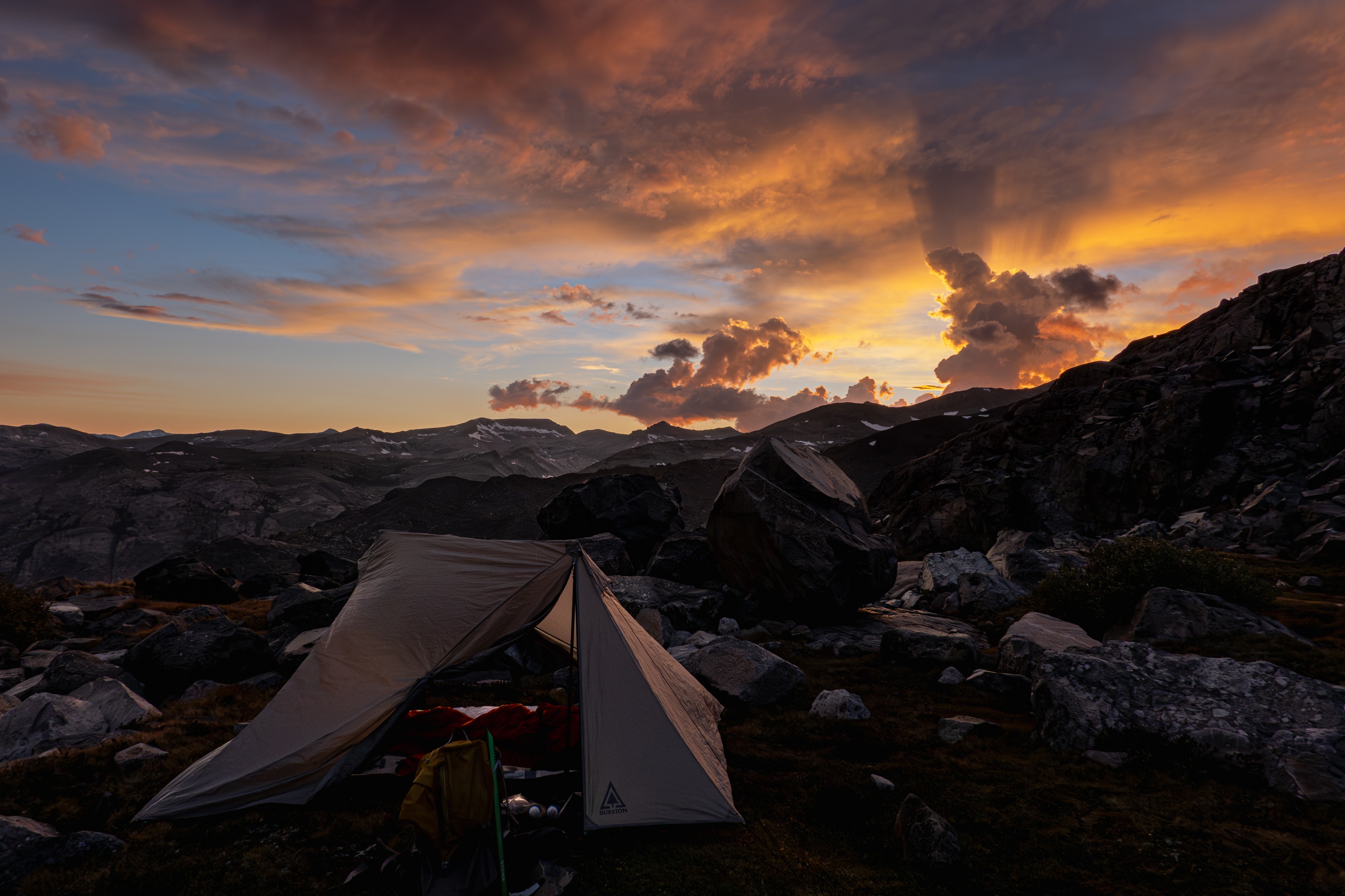
Spot is a legend! He laid the skin track going up Mount Wood this past winter, about a 5,000ft climb on snow. So efficient ha! So you’re a few days in on this second leg. There are some challenging passes around here, right? Plus a record winter snow year, so the alpine is holding more snow too.
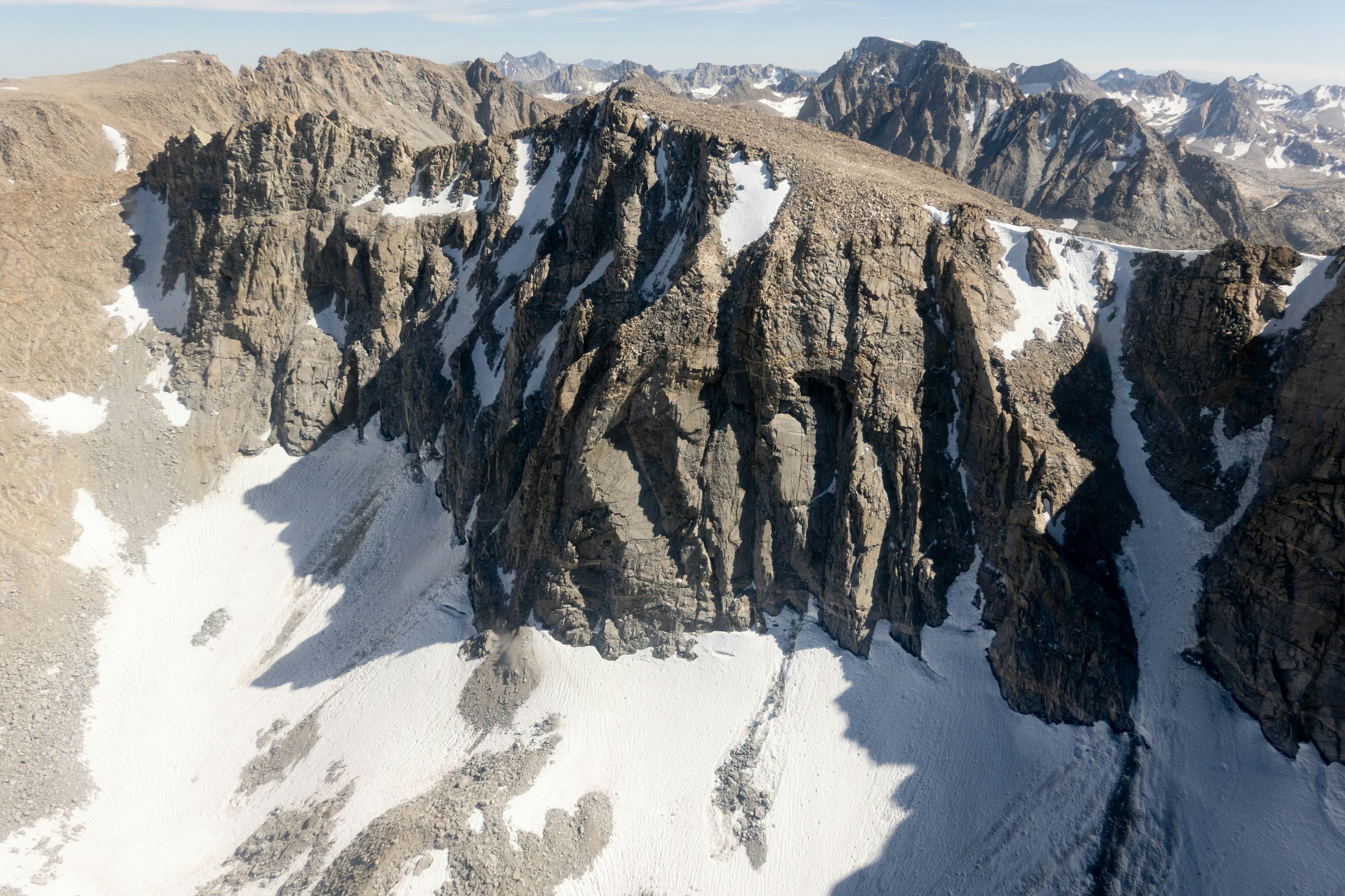
I wouldn’t say any of the passes were easy necessarily, but Puppet Pass and Snow Tongue I guess are notorious. Wow, this is a strange real-life foreshadow moment—but as I’m think about this I remember a small interaction Lucas and I had between two people just finishing the high route at Twin Lakes as we were on our first day. They inquired about our route and timing and tools. I remember the shorter guy mentioning something about Snow Tongue pass. How odd!
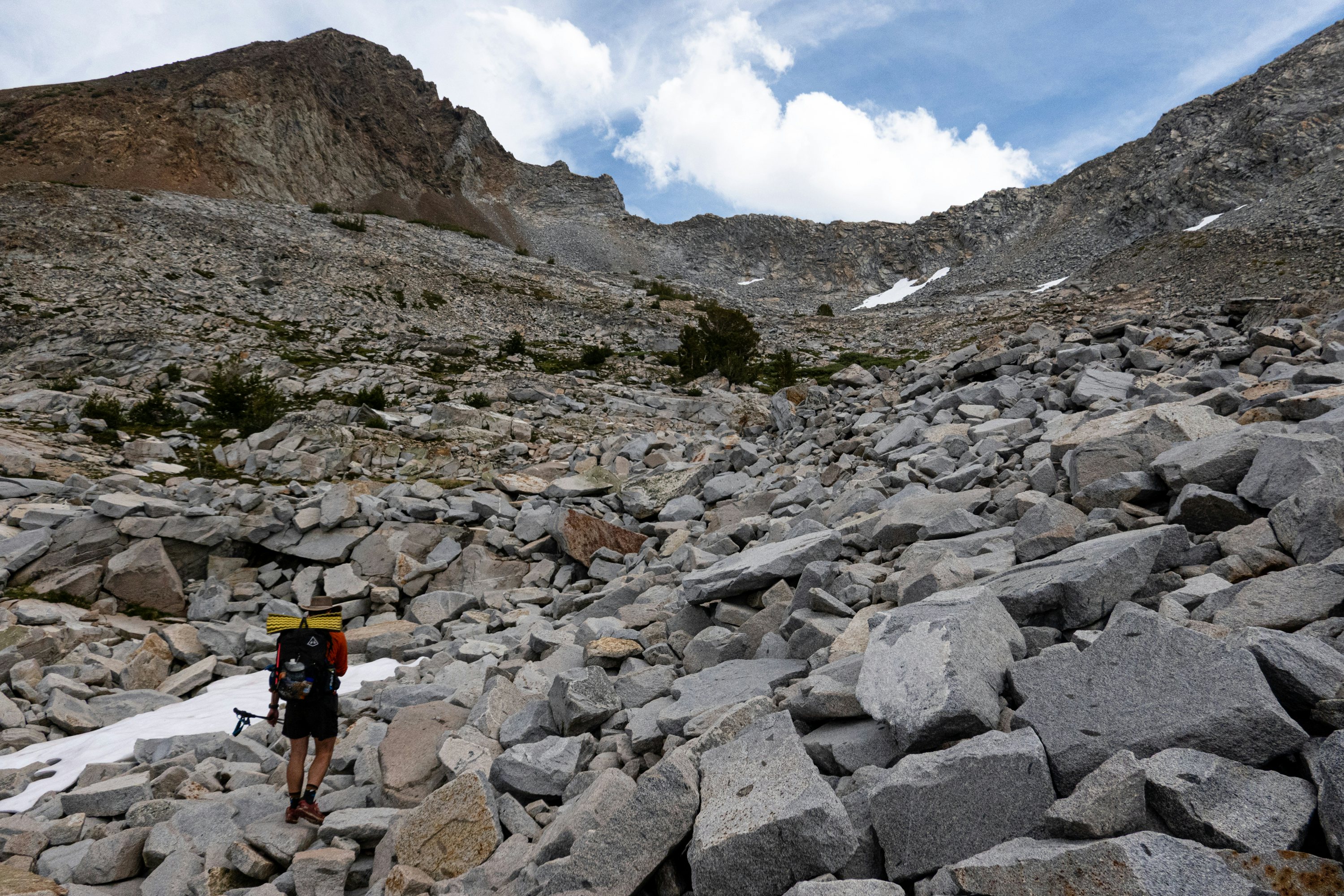
To answer your question, yes, we expected the alpine to hold more snow due to the deep winter and cold summer. So we brought ice axes and micro spikes as a precaution, though we didn’t expect to use them too much.
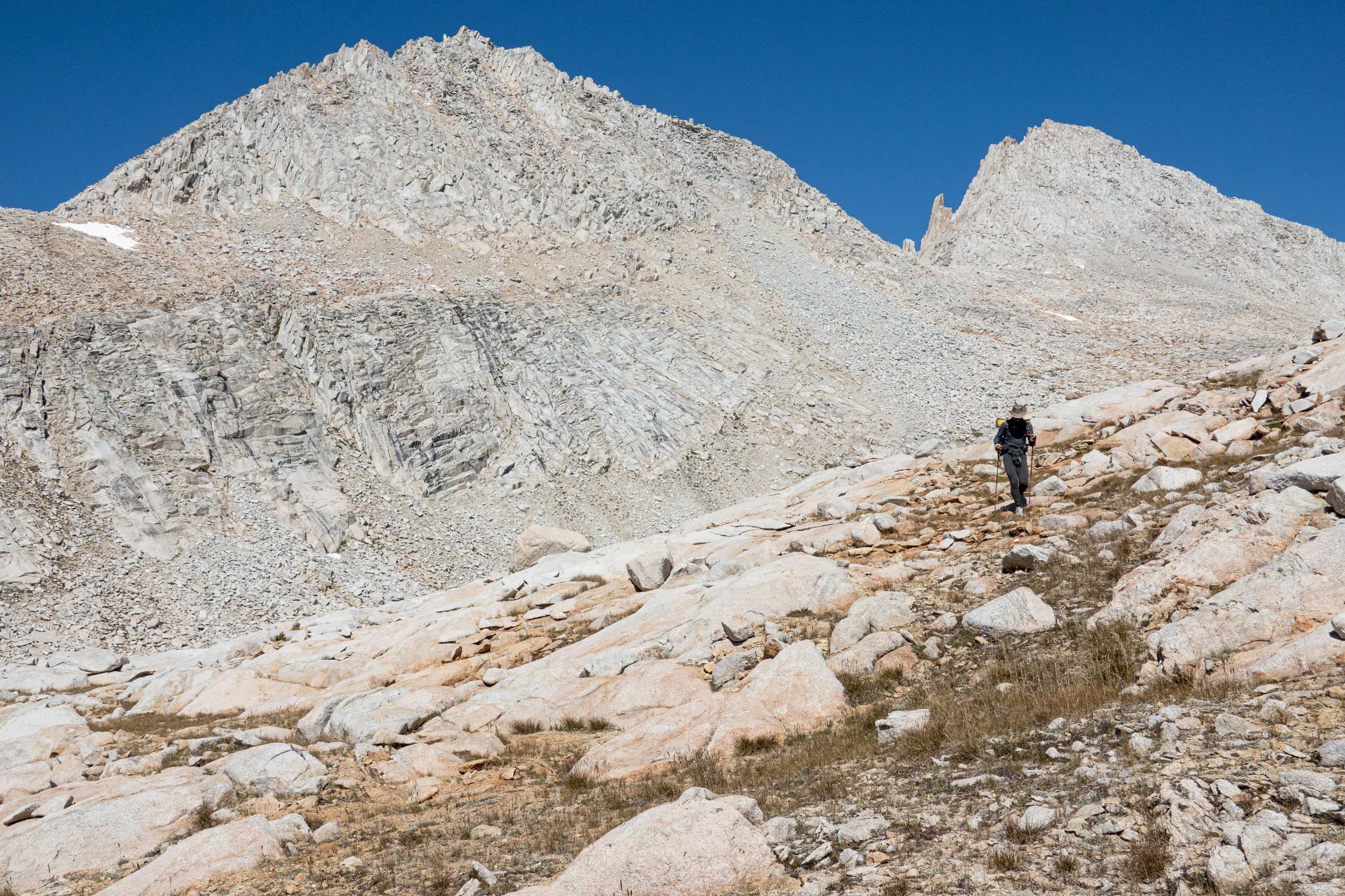
You’ve previously done sections of the SHR, and are at this point several days into the trip. You know alpine passes. This might be a leading question, but tell me about Snow Tongue pass.
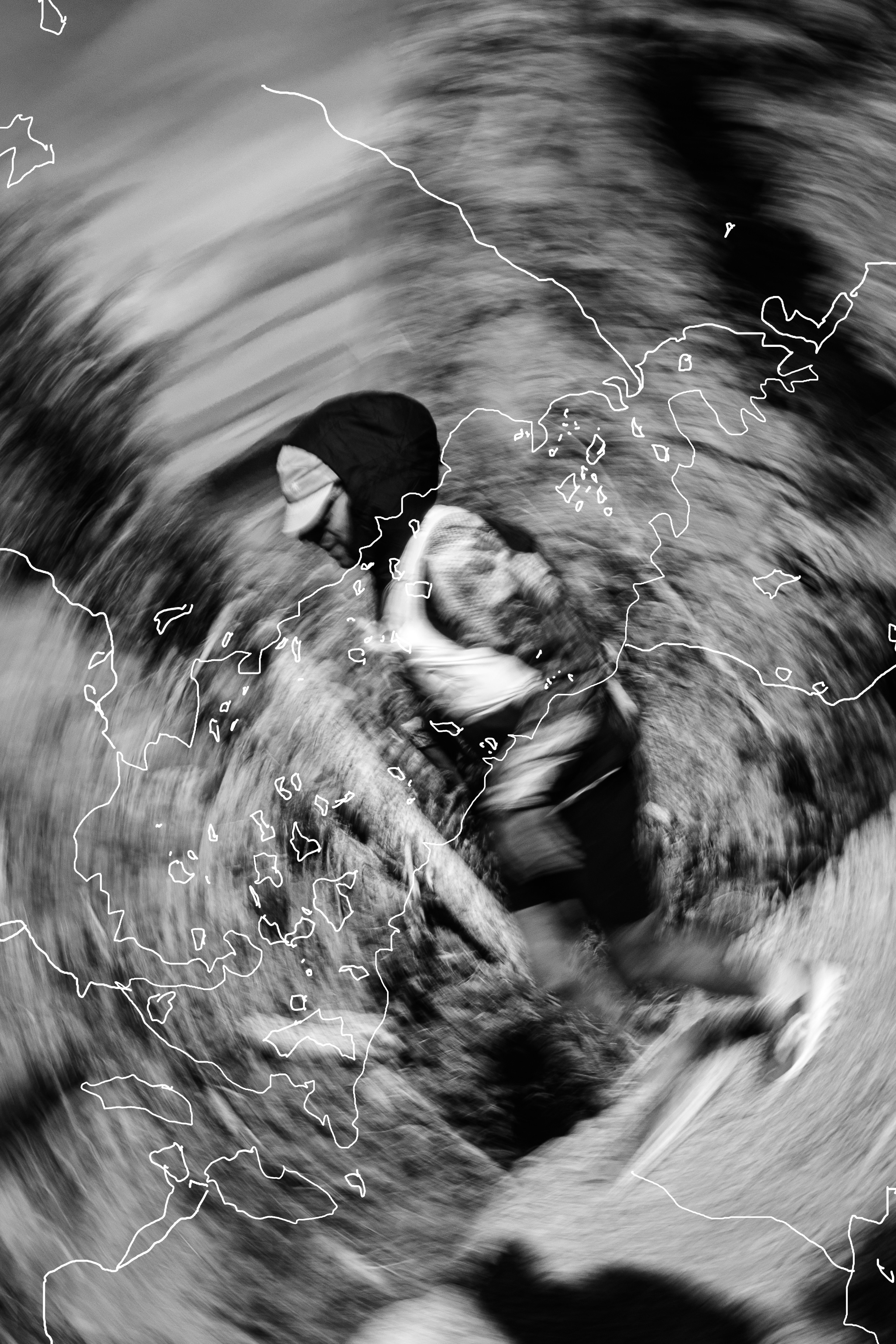
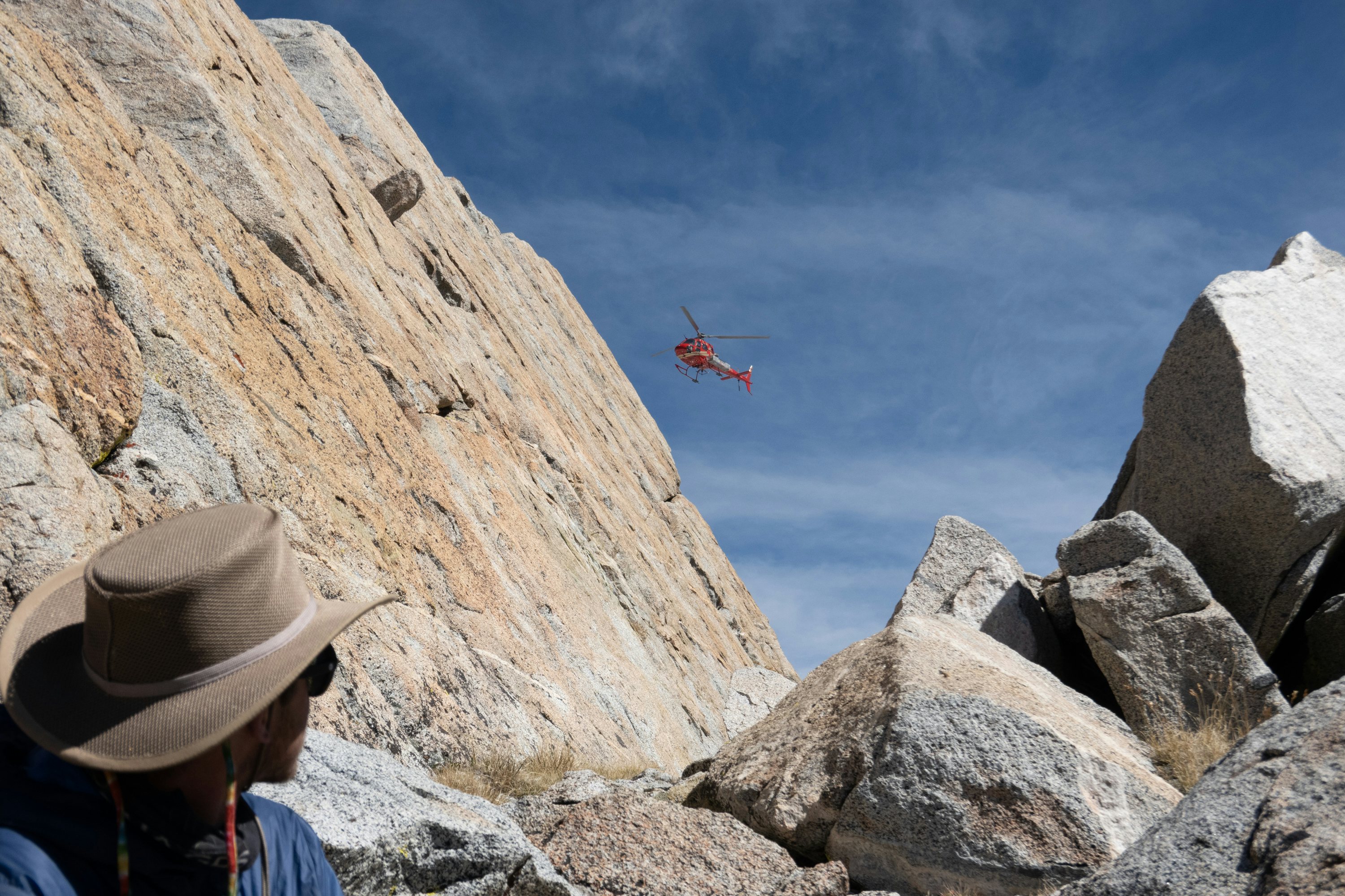
Well, in an effort not to bury the lede here, I sustained an injury climbing Snow Tongue that ultimately cut short my journey on the high route. As I was climbing over a boulder near the top of the pass, it shifted and crushed my foot. I was able to crawl to the top of the pass and from there Lucas called Search and Rescue. Within six hours I was essentially plucked up off the mountain via helicopter and transported to a hospital in Bishop.
Snow Tongue is not too different from the many other high alpine passes we climbed before, but it was notably more loose with sand and small talus along with being rather steep. Traveling the high route you have to trust your life to thousands of boulders like that one every day. My number must have been up because this time it rolled and crushed my toe. Though I keep reminding myself—it could have been a lot worse.
Wild—so you were carrying an inReach? Was that the first time you’ve been in a group which had to use one? Can you talk more about the sequence of events and how you assessed the situation? Was it immediately clear how serious it was? Ok, a lot of questions, ha!
Ha, yes, a lot of questions! I have some answers.
Yes, Lucas and I both were carrying Garmin InReach devices. This was the first time i’ve used the SOS feature. It was immediately clear to me that I couldn’t bear weight on my left foot and that I was in significant pain. I’ll spare you the gory details but we both realized I wasn’t walking out once we took off my shoe and sock and saw the carnage that rock had befallen my poor toe.
The InReach device is really rad. Once you press SOS, the device does a little 20-second countdown and beeps loudly. Within a few minutes we were connected to the Sequoia Kings Canyon National Park Search and Rescue. I got a text that basically asked, “Hi Ethan. What’s going on?” I told them what had happened and from then on it was a waiting game until they somehow picked me up.
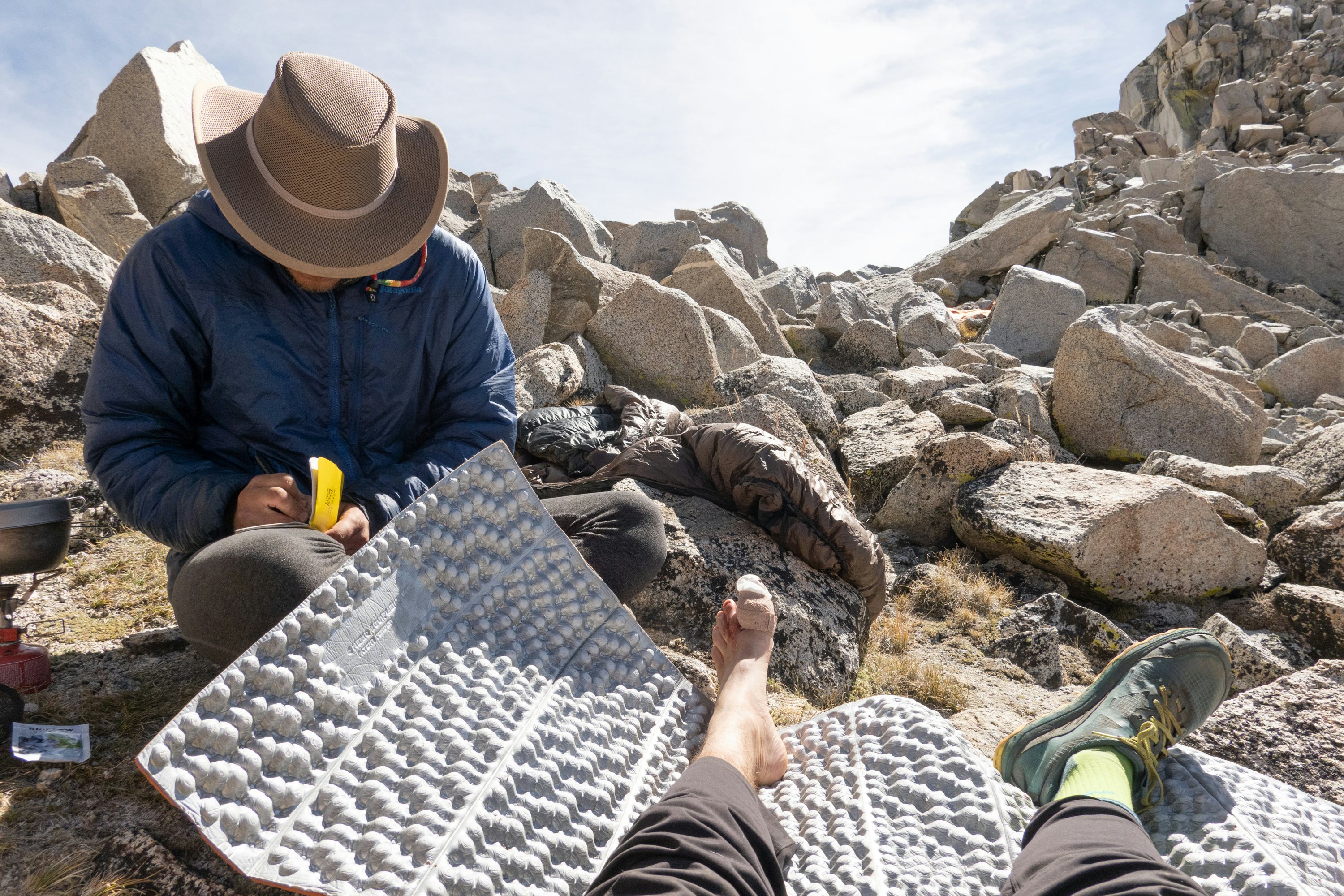
I will note it was really great to have my friend Lucas there not only for company but because he had recently taken his WFR training. He took my vitals and SCTMs of the toe every 30-60 minutes and took notes on whatever medication I took as well. This was helpful for the responding SAR team and helpful for me—I was kind of out of it, despite just a toe injury, so it was great having someone paying attention to the timeline of things. We had no idea if my toe was getting any blood flow, if it was broken, etc. So it’s good to have training and take notes.
Yeah—it's important to balance the fast and light approach with being able to treat an accident like this. What was the sequence after they arrived and did the assessment?
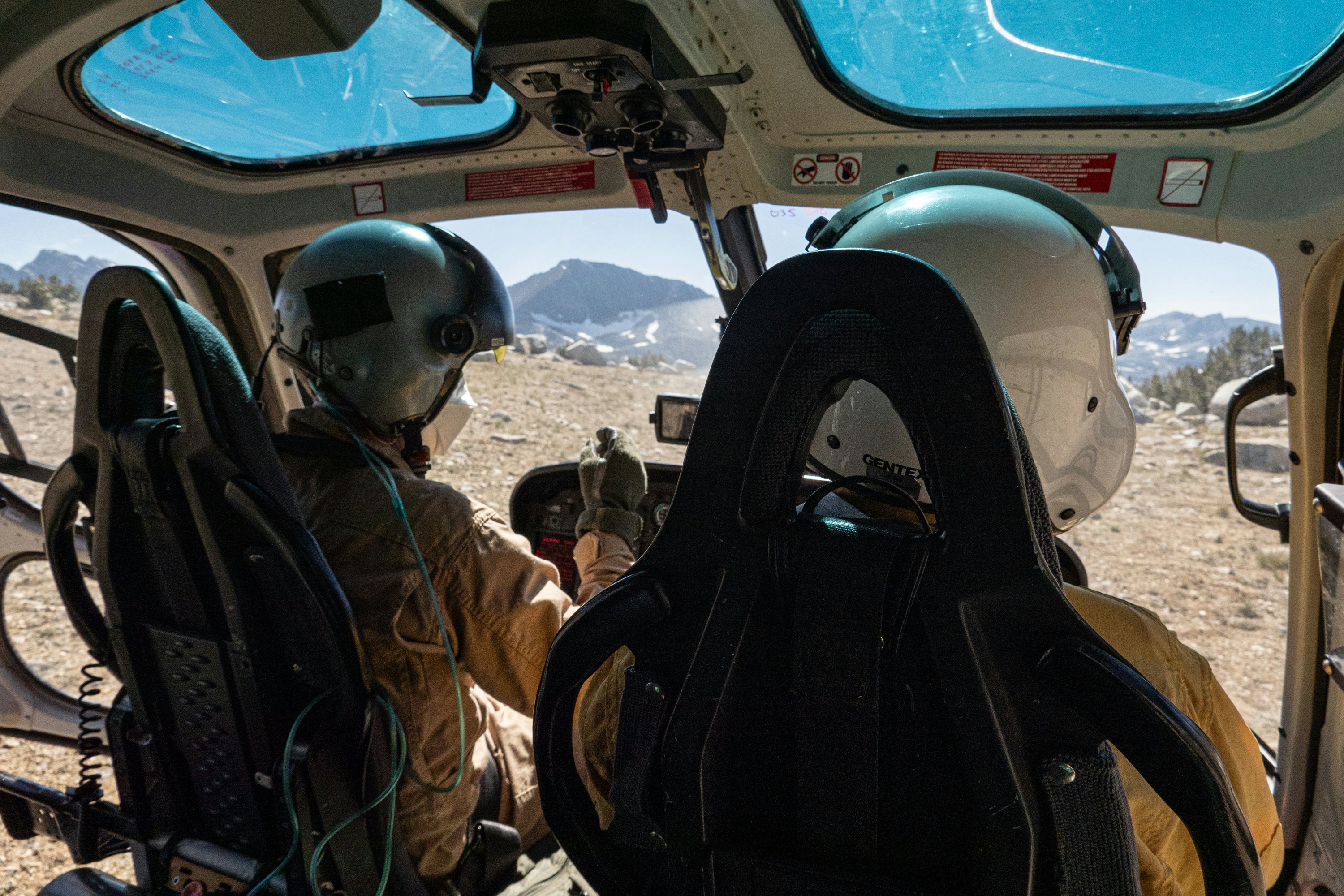
In my case, the first responding SAR ranger arrived around the same time the helicopter found us—about four hours after we called for help. Colin is stationed in the McClure Meadows ranger station, just below where the accident occurred.
He took health notes from Lucas and took another look at my toe. He had a big radio and was in communication with the helicopter team. After we wrapped up the medical assessment, we packaged up my foot for temporary transport and Colin notified the helicopter team we were ready.
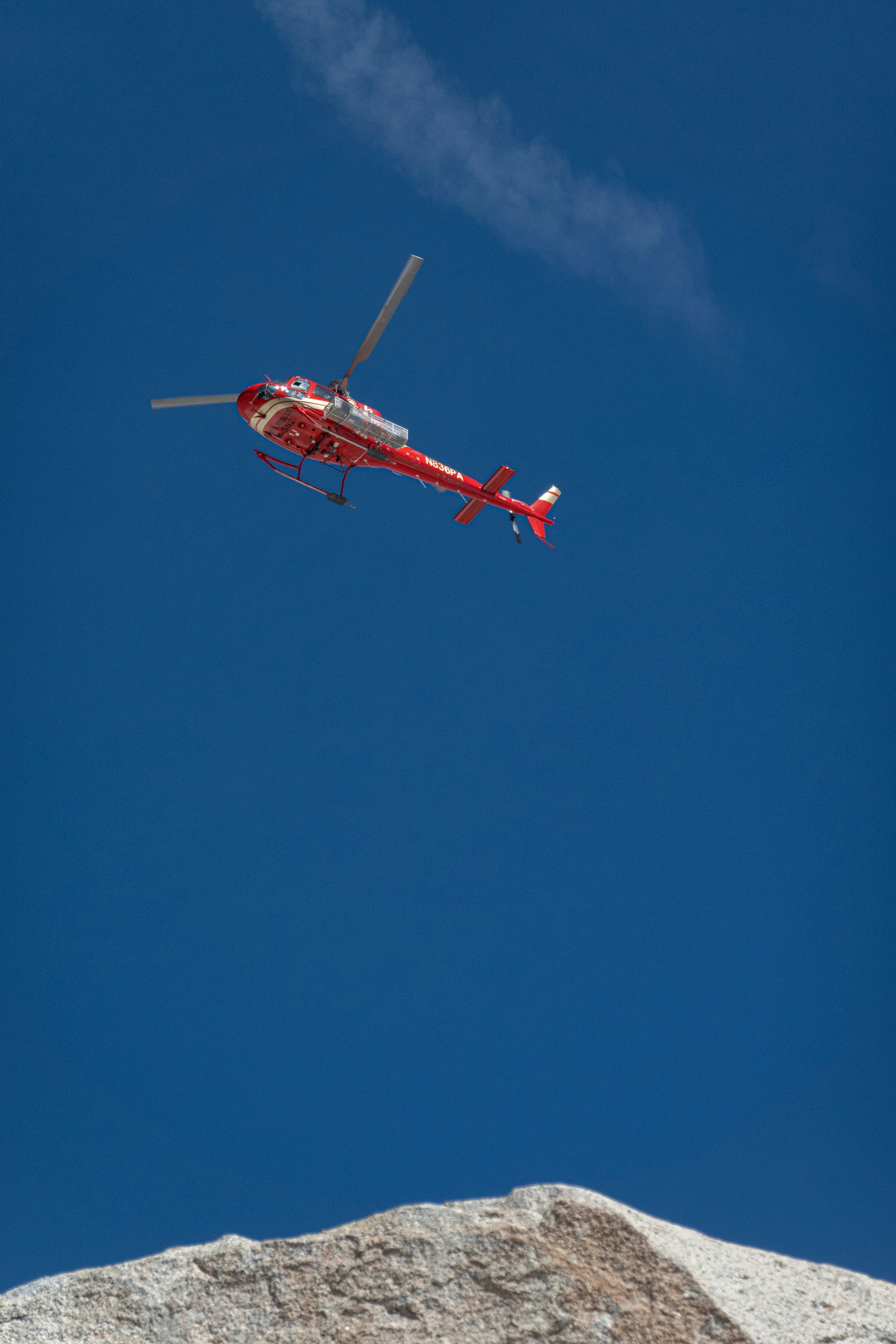
The helicopter couldn’t land up near us so they had to do this thing called a “short haul.” Essentially SAR member Erik dangled from a long rope beneath the helicopter and got dropped off with me. He packaged me in essentially a giant nylon diaper and signaled for the helicopter to come back. We hooked back into that rope and they lifted us both down to a lower lake.
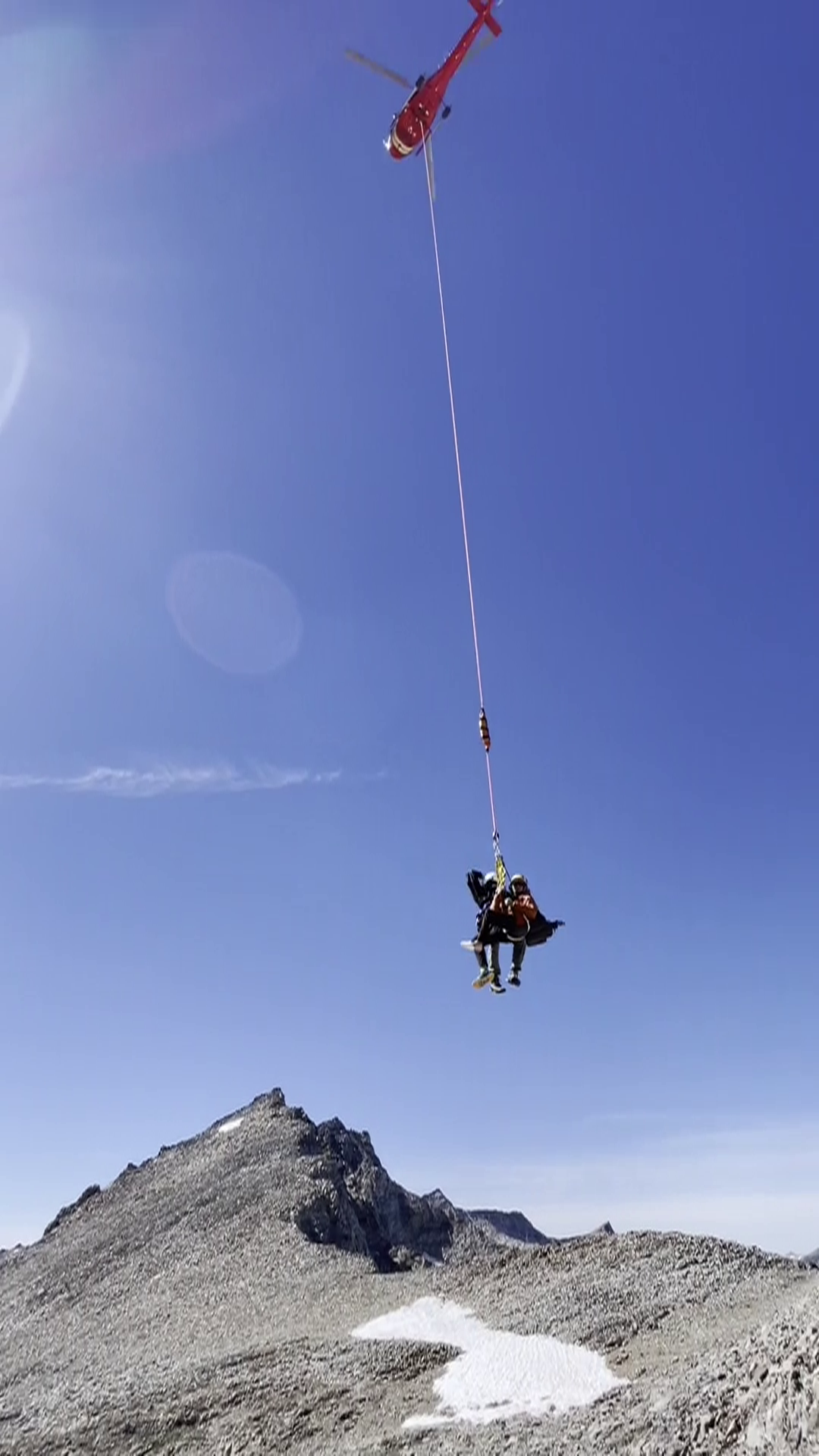
The team had taken a lot of the helicopter apart to save on weight to keep the heli maneuverable at that altitude. So they latched a lot of gear back on and put the doors back on. Then we flew to the Bishop airport.
I got out, signed a few papers, expressed my deep gratitude, and we all went on our way. The accident happened at 8:30am and by 3:30pm I was in the ER. Kind of incredible when I really think about it.
Wild. What was the prognosis?
I found out after an X-ray that my proximal phalange of my left big toe was crushed into 6-7 pieces. I have a framed photo of the X ray in my room.
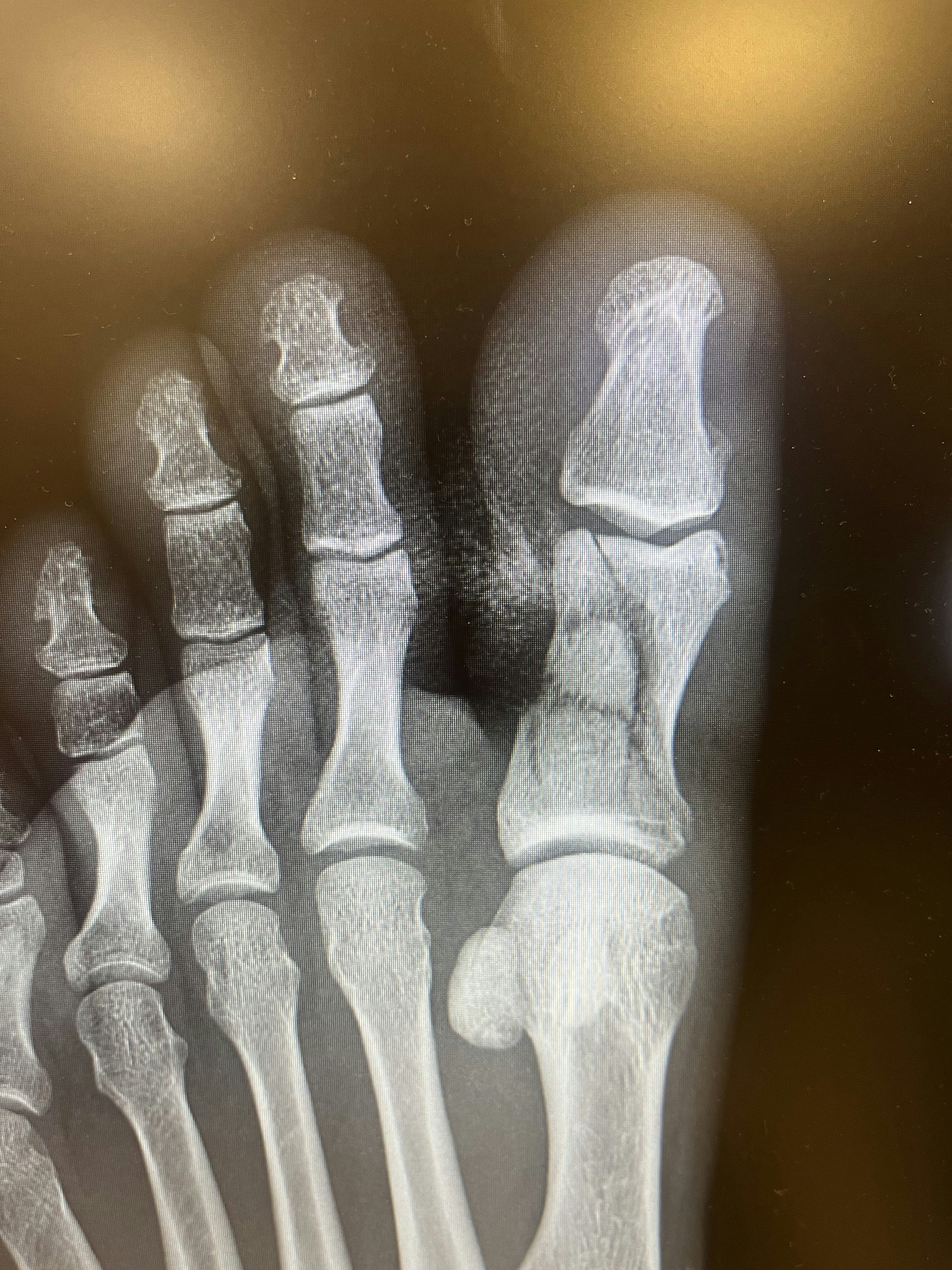
Surprisingly none of the other bones were seriously damaged. The majority of the healing happens within the first four weeks after a bone break, in which time I was advised to take it very easy.
I’m four months in now and i’m working on regaining full mobility to the joint between my distal phalange and my proximal phalange. Very luckily I didn’t sustain great damage to the joint with my metatarsal bone and almost have my whole range of motion back there which is most important for normal walking and running activities. I’ve been cycling, skiing and running conservatively to maintain fitness and sanity.
I think it will be another 8 months before I’m fully back to “normal.”
So now that there is some distance from the incident, and you’re deep into recovery, which is so great to hear, what are some of the things you’ve learned from it? Anything like this is such a good reminder to revisit the heuristics we should take out the door with us.
About half of everybody’s first question was: how much is the bill for the helicopter ride?
The answer: I don’t know! Because, thankfully, rescue costs in national parks are not passed on to the victim. Also, a two-way satellite communication device is worth the money.
Yes! The InReach is great, not as a means to take additional risk, but precisely in these freak situations. Letting someone know where you’re off to and for about how long, set the tracking interval to once every 20 minutes, and give them the link.
The process of applying for disability was worse than actually breaking my toe.
I had a similar experience when doing the PCT. Went over the backside of Glen Pass and ran into someone who had just had a fall. He attempted to arrest using his ice axe and put it just about straight through his other hand. Was the most gore I’ve ever experienced in real life.
He was french, and when I asked him how he was, he said “Do you know how I will pay for this? How does health care work in this country?” A whole group was gathered around working to help stop the bleeding, calming him down and saying it’ll shake out, but yeah…
People are genuinely nice and looking for ways to be helpful. I think it’s one of the ways humans find meaning —in helping others. Initially it wasn’t easy being injured and letting other people do things for me, but it was easier when I was literally incapacitated and forced to do so.
Deeply insightful.
Overall I feel grateful and a bit overwhelmed when I think back.
From the day of incident response by my hiking partner Lucas to the four SAR team members to the half dozen or so doctors that took me through minor surgery and the dozen or so nurses who aided that process and the literally dozens of friends who have accompanied me through this recovery journey all I really feel is thankful.
All photography courtesy of Ethan.
Shoutout Spot 🐶