Field Report
Spring Skiing on Mount Gould
A memorable spring day on the planks out of Onion Valley

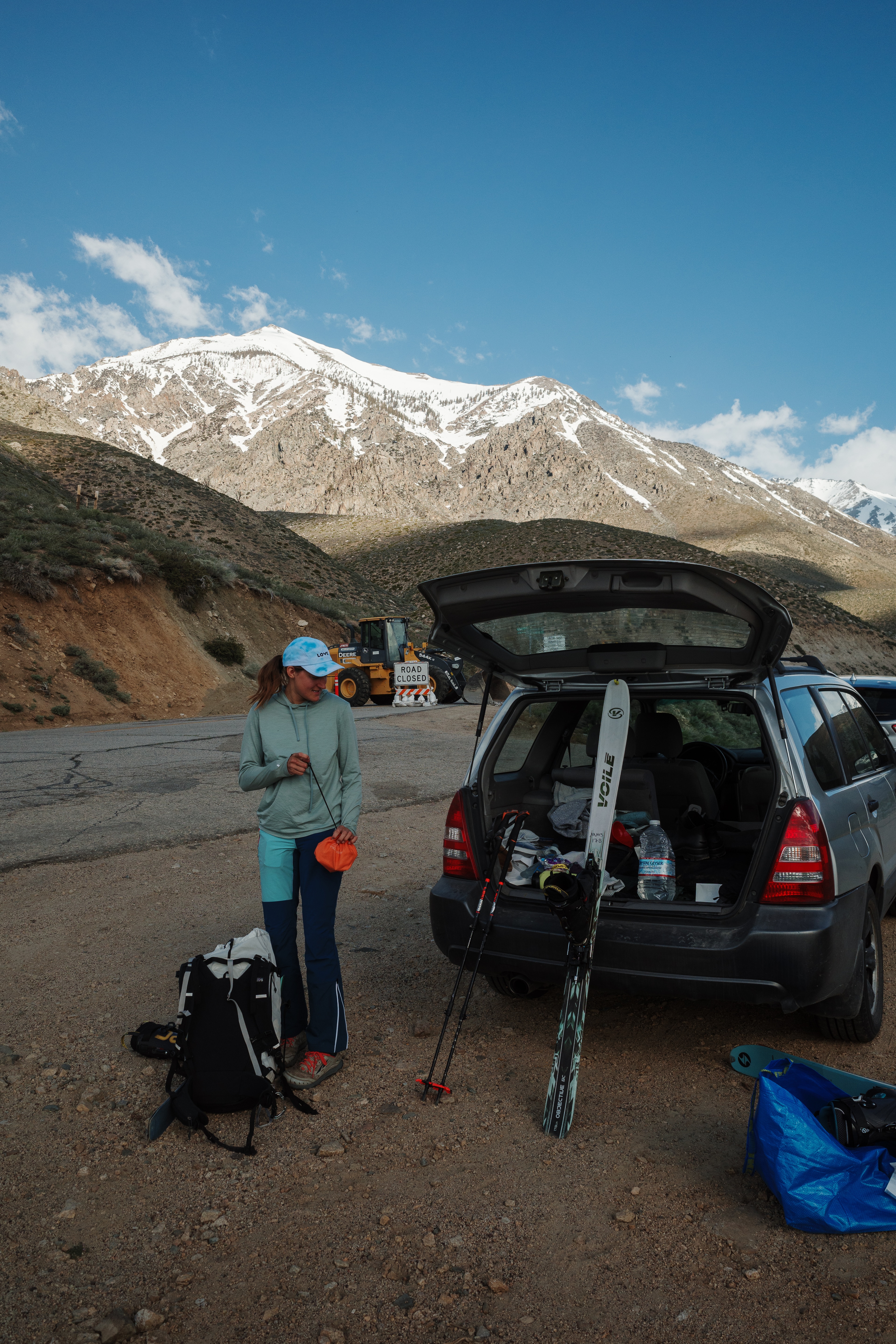
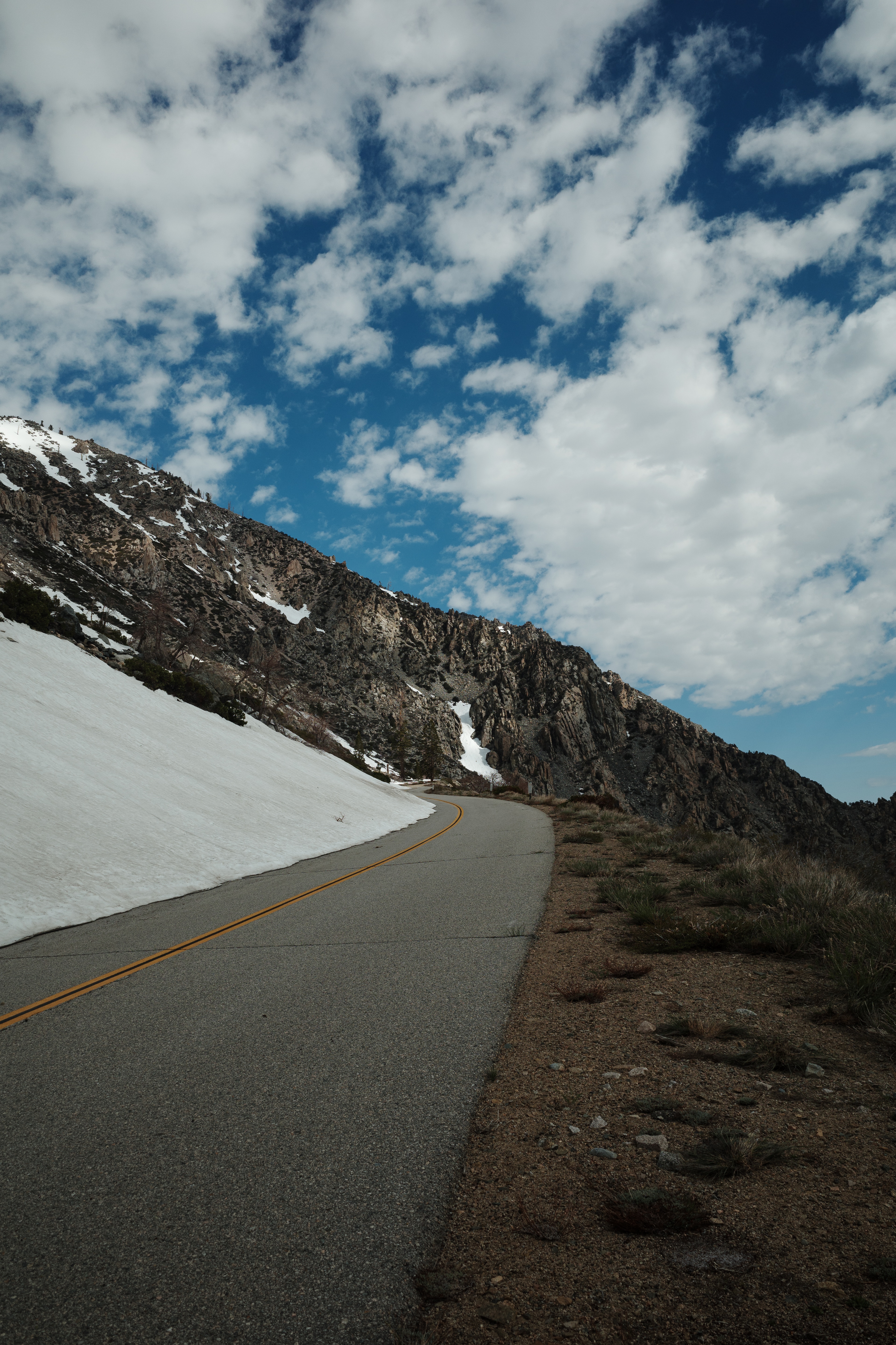
Rumors gave us hope. But now that we’re here, a bulldozer (and a locked gate) are blocking the road ahead up Onion Valley. Could my car squeeze through the gap between the two? Maybe. Could we get away with it? Maybe. Is smoke coming out from under the hood of my backcountry beater after doing the first bit of the climb? Yes.
Five miles and twenty-five hundred feet of road walking; a nice little treat to start the day.
ok so this isn’t ideal, but it’s a nice day. whatever.
i’m alright, had to get creative w/ the voile straps on the fastpack to cary the skis and boots
ari’s pack weighs a ton w/ like 40lbs of food 💀
we’ll swap packs a couple times on the climb to even out the load
(lol jk)
Ari is a week out from skiing a section of the Sierra High Route. It’ll require putting fuel—hopefully something tasty—in the tank along the way. A record snow year made travel difficult, keeping me up north, and I was looking for an excuse to have a big day further south.
This intersected nicely with a good zone for food caching along Ari’s route, making me an easy recruit to assist in lugging calories up a couple thousand feet of vertical.
wtf there is a car parked in a turnout here? how the hell did they get here? are we missing something?
uh should we turn back and drive?
whatever
the line is way more aesthetic with an extra like 10 miles and 4k vert roundtrip of possibly unnecessary road walking
The snowline finally emerges ahead, only a few switchbacks beneath the Onion Valley trailhead. At least it wasn’t necessary to pound pavement the entire way. We transition from trail runners to ski boots with stupid grins.
Independence creek funnels through the canyon here, and the snow bridge crossing it is barely holding on.
yeah uh maybe you should try crossing that snow bridge first
since you have like 100 lbs of food
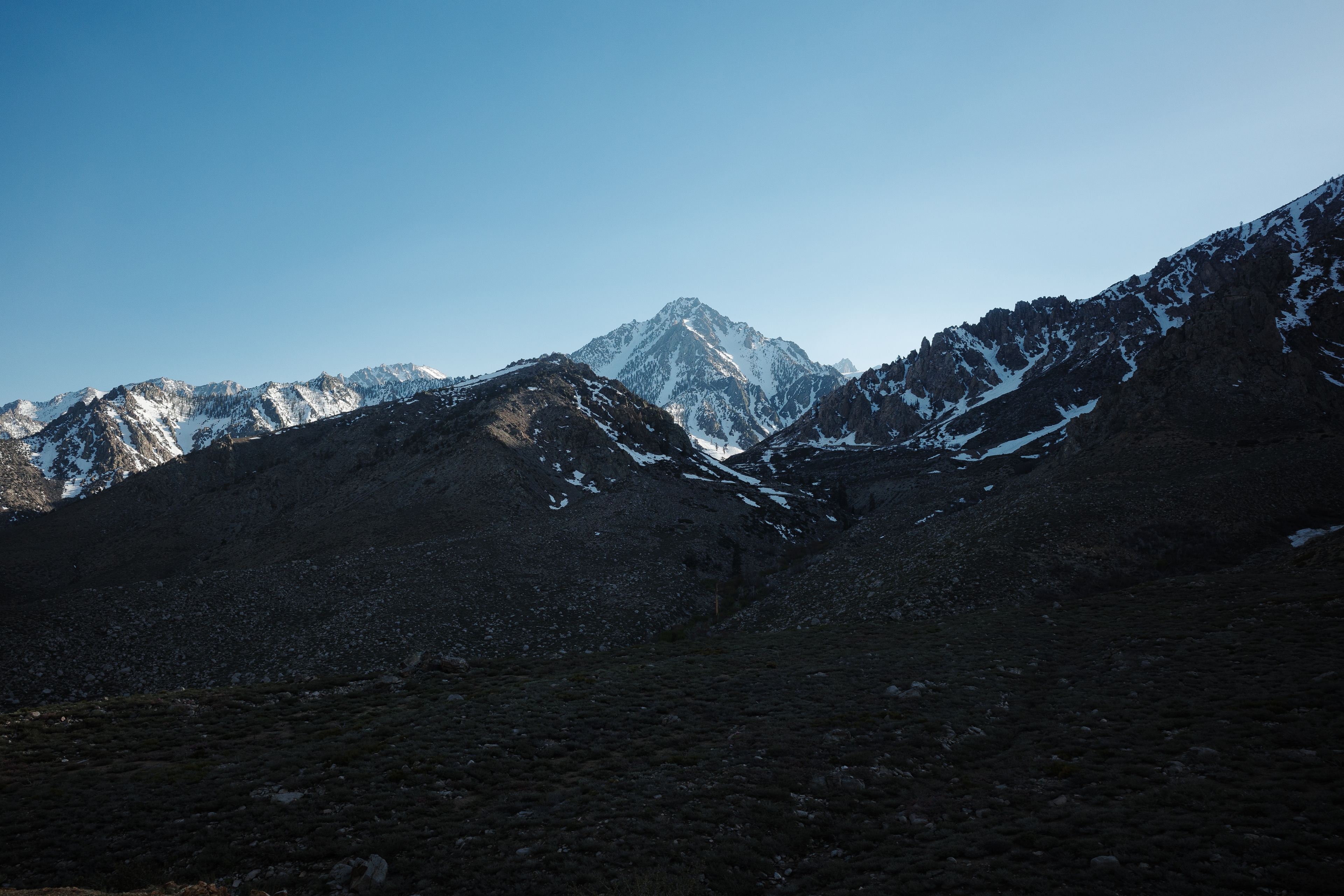
This is my first time in the Onion Valley zone around Kearsarge Pass. It’s a busy destination in the summer. Why spend time in high traffic areas when the Sierra sprawls out towards the horizon in every direction?
Well, it turns out the place has some views, and we’re two of only a couple people out here, as evidenced by the other pairs of shoes discovered when pulling up at snowline.

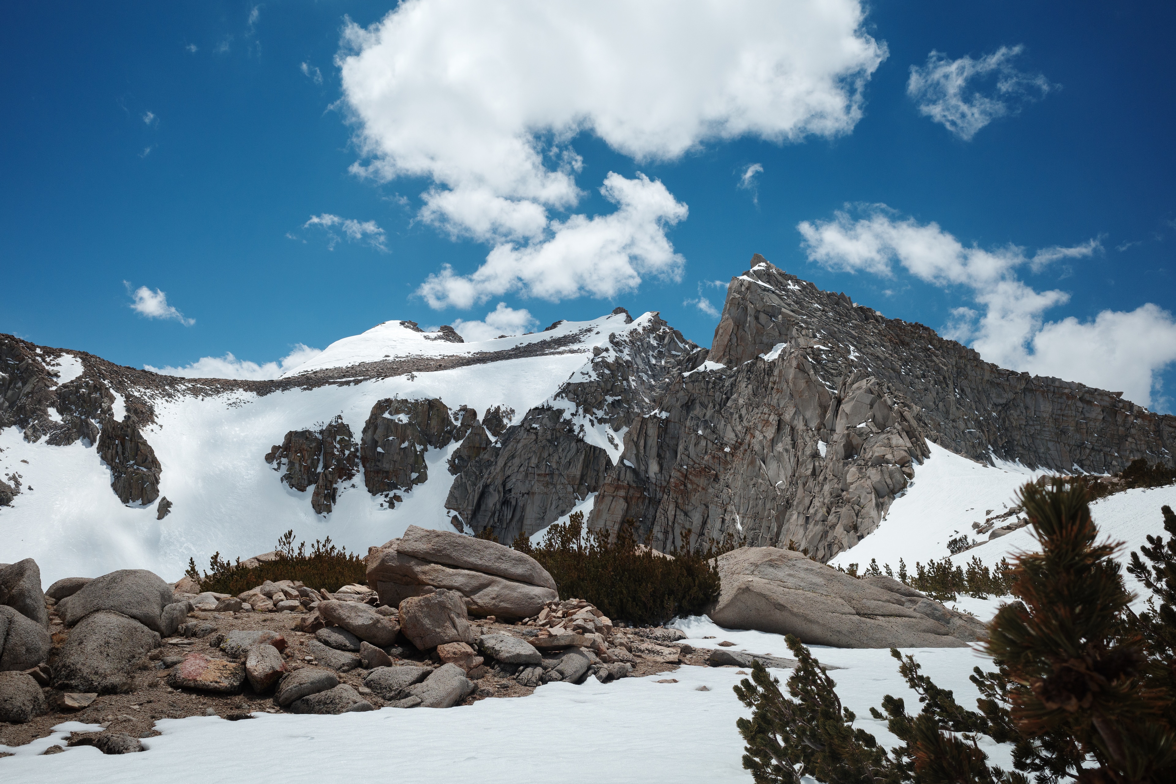
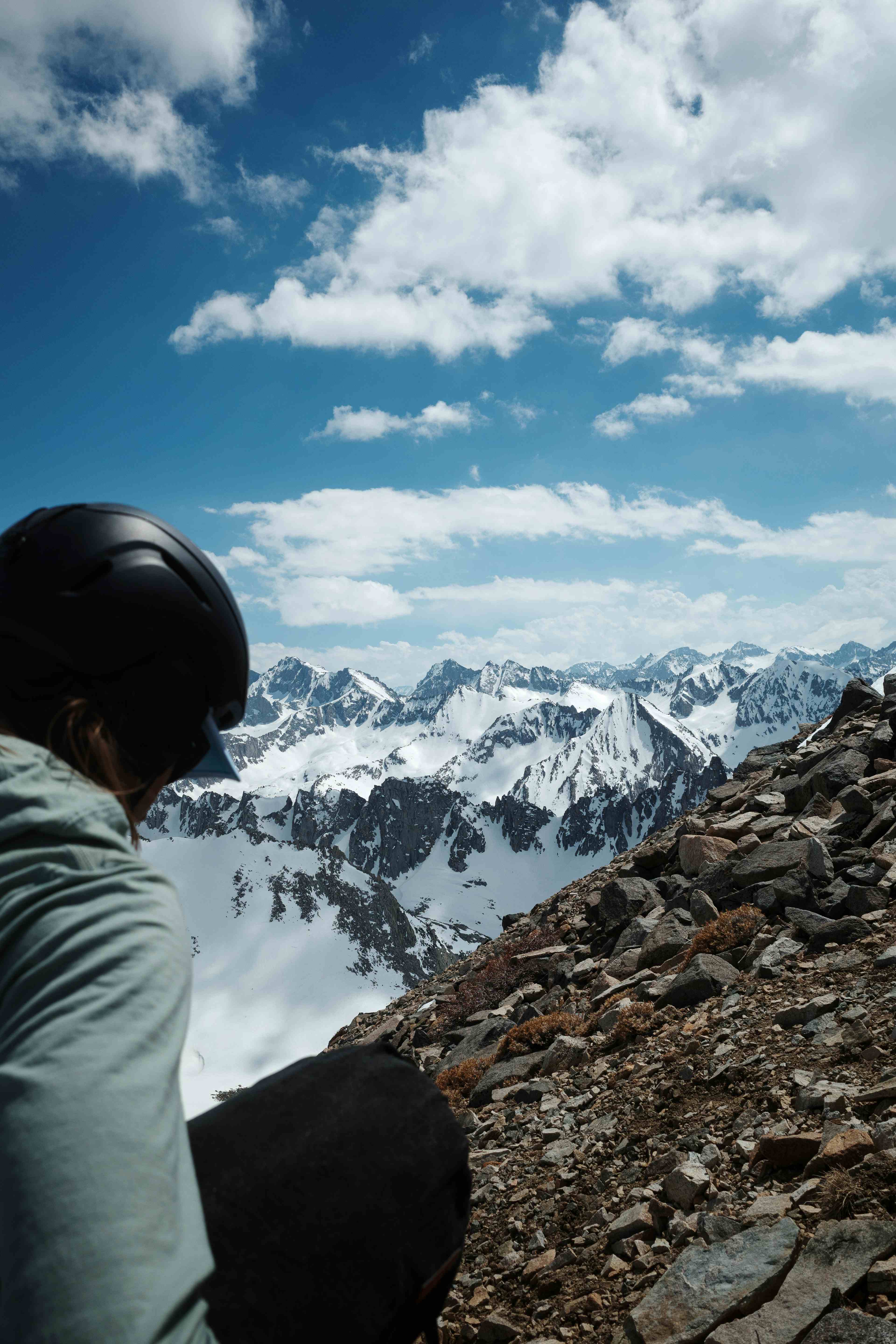
University, Independence and Kearsarge peaks intercept sightlines while the necks gawk around. Massive sheer drops framing glacial cirques where frozen lakes are tucked away. We stop for a snack break and crawl out to the ice on my belly towards a hole to top off on water.
Some of the lake is beginning to unfreeze, and I consider how this would be one of my least favorable ways to die—punching through while sprawled out on the ice, water bottle in hand.
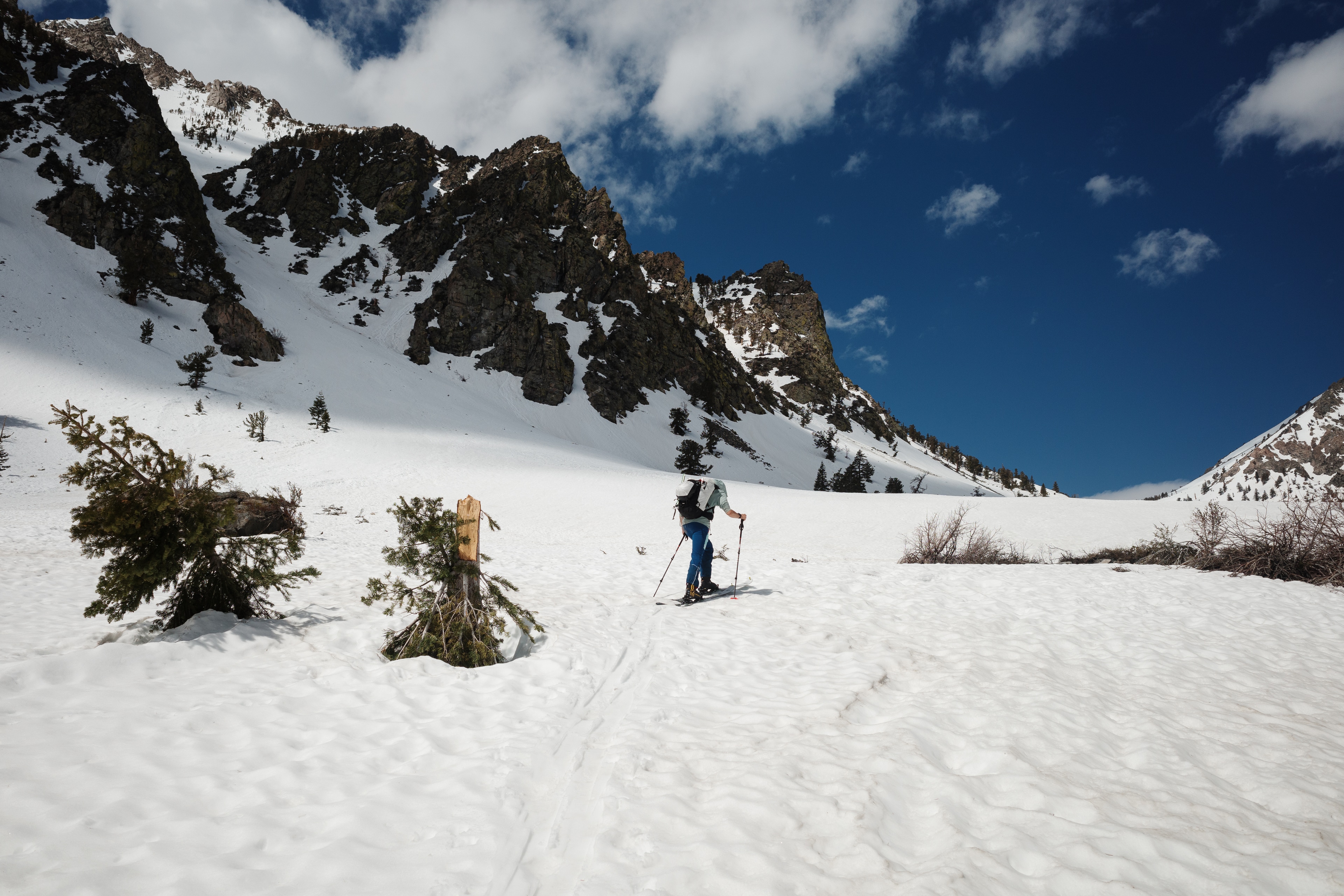
Our plan draws a line up the drainage descending from Golden Trout Lake towards Mount Gould, lookers right of a rollover leading towards Gilbert Lake and Kearsarge Pass.
wait, look at this
are we going up the right drainage?
ah… no…
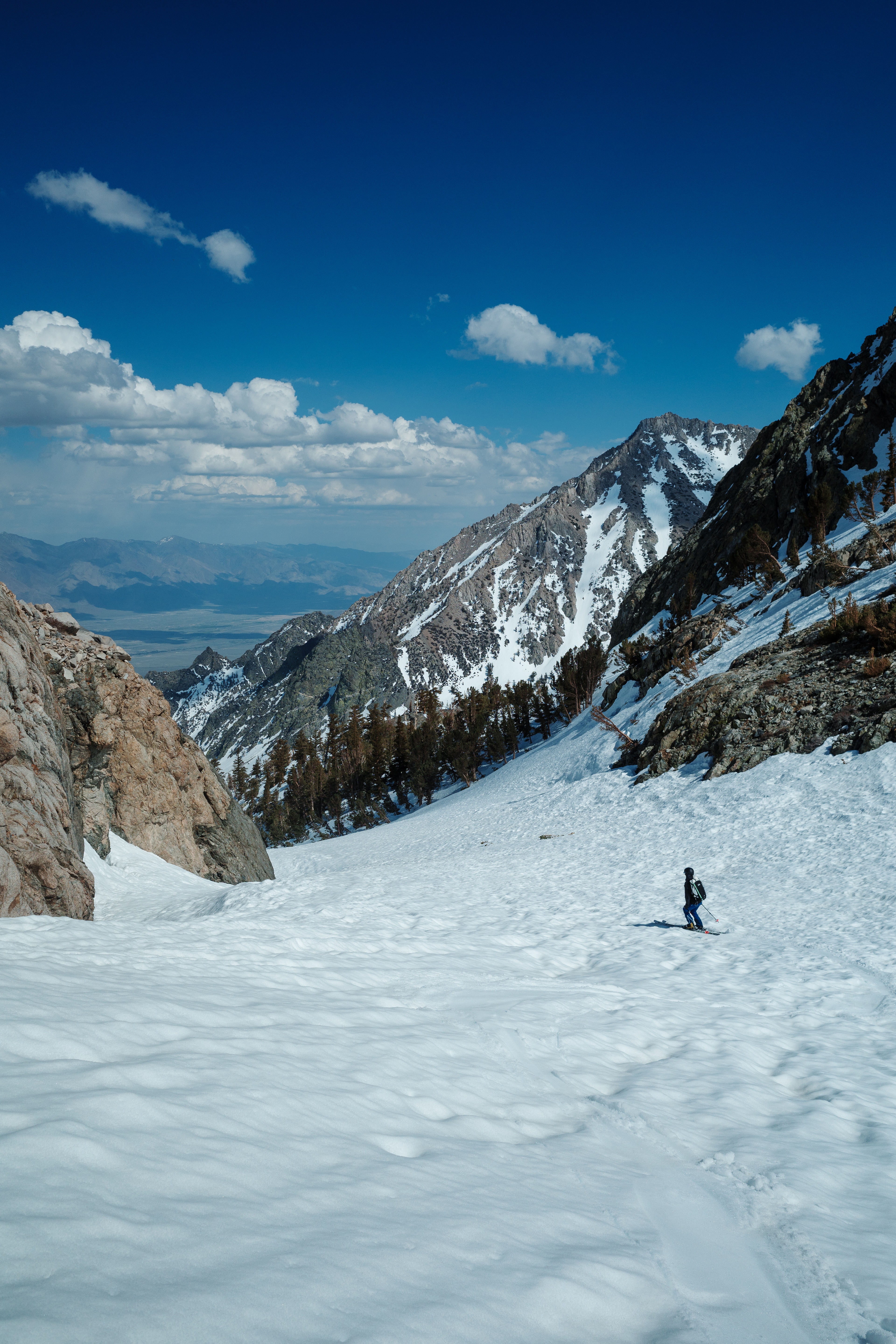
Frustratingly, a navigational fluke sends us towards Kearsarge, and traversing to correct course isn’t an option. So up we go, not wanting to back track, the frustration quickly vanishing after acknowledging how out of control the surrounding scene is.
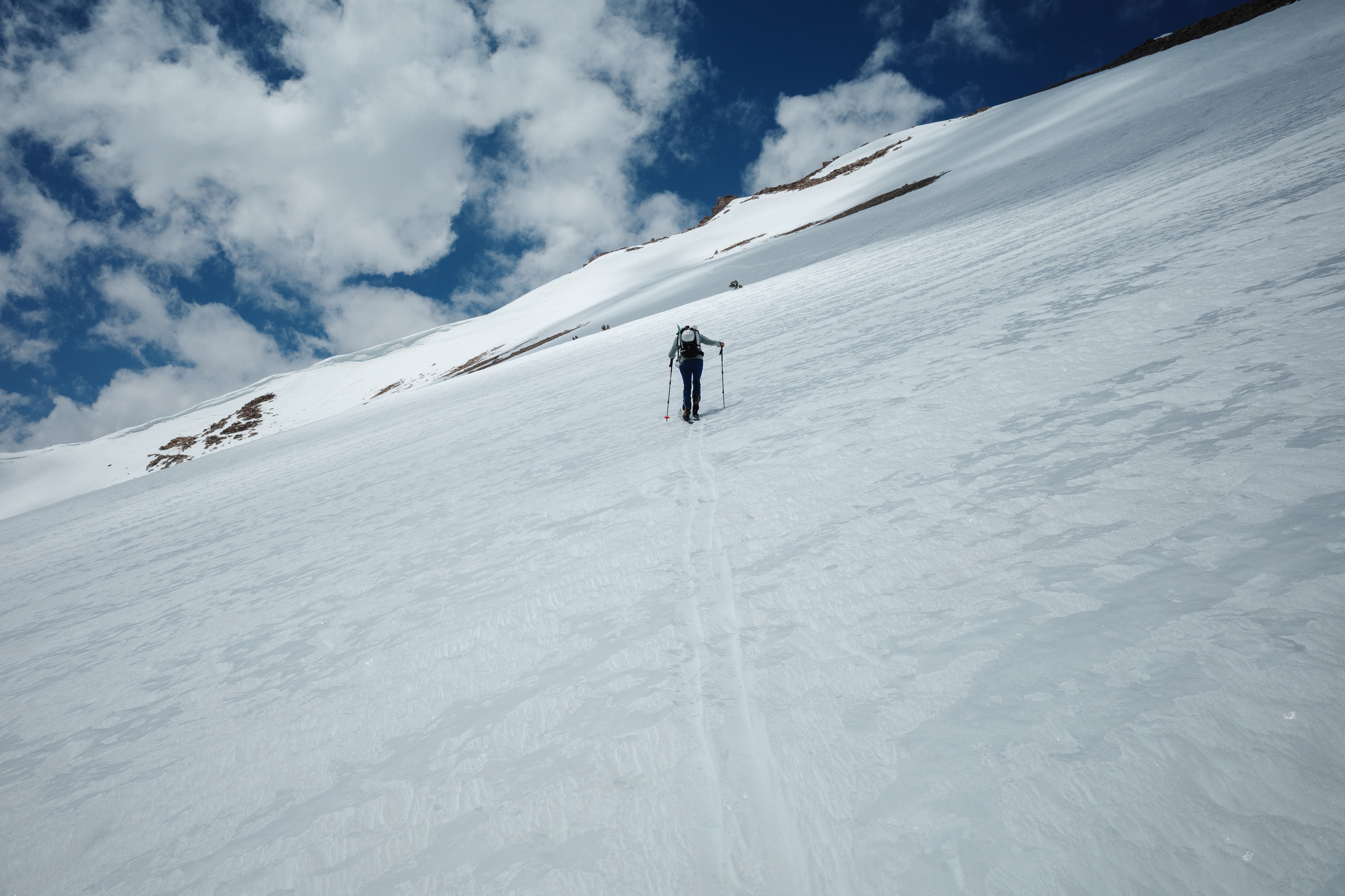
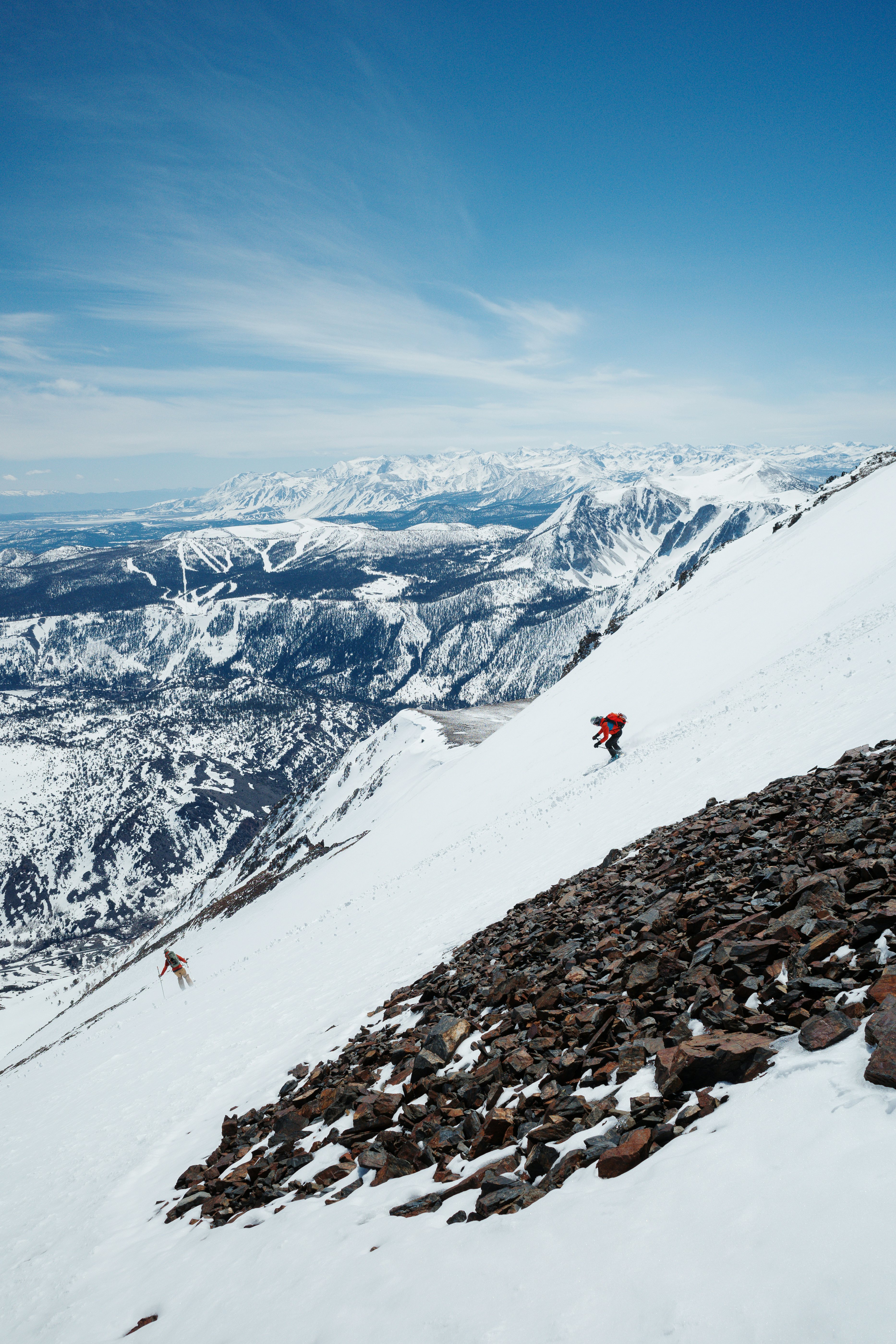
The edge of my ski glides along the sun-sculpted south aspect of the final thousand feet separating us from the summit. This doesn’t look like particularly good skiing.
No worries.
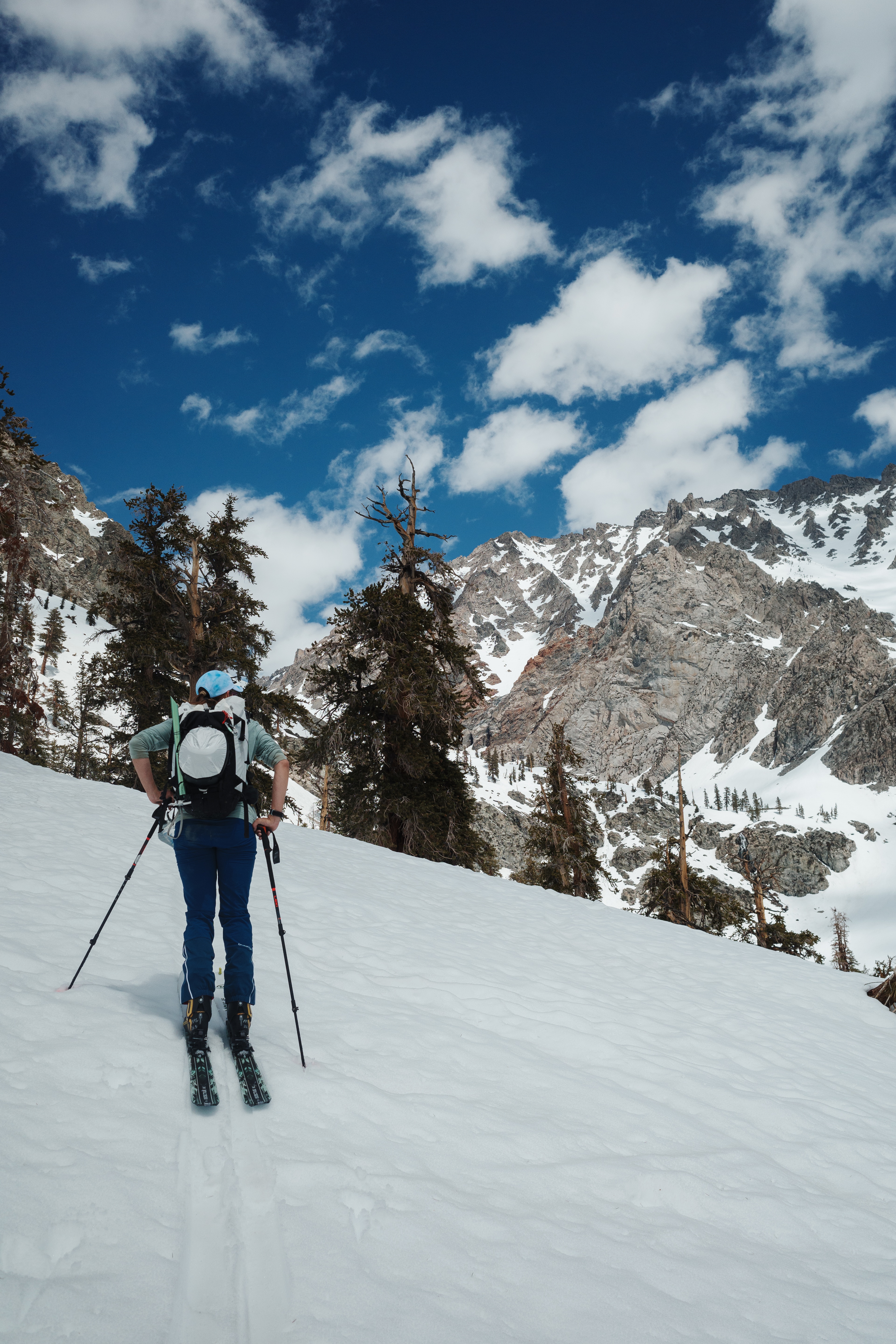
We plan to ski down the north aspect following the Golden Trout drainage, the originally intended ascent line. The temperature is noticeably increasing, and the effects of solar action on the snow becomes a consideration. We’re confident conditions will remain thermally acceptable at elevation where the steepest terrain remains.
this actually works out you know
going up the south aspect and descending the north, it’s a nice loop now instead of an out and back
freudian line
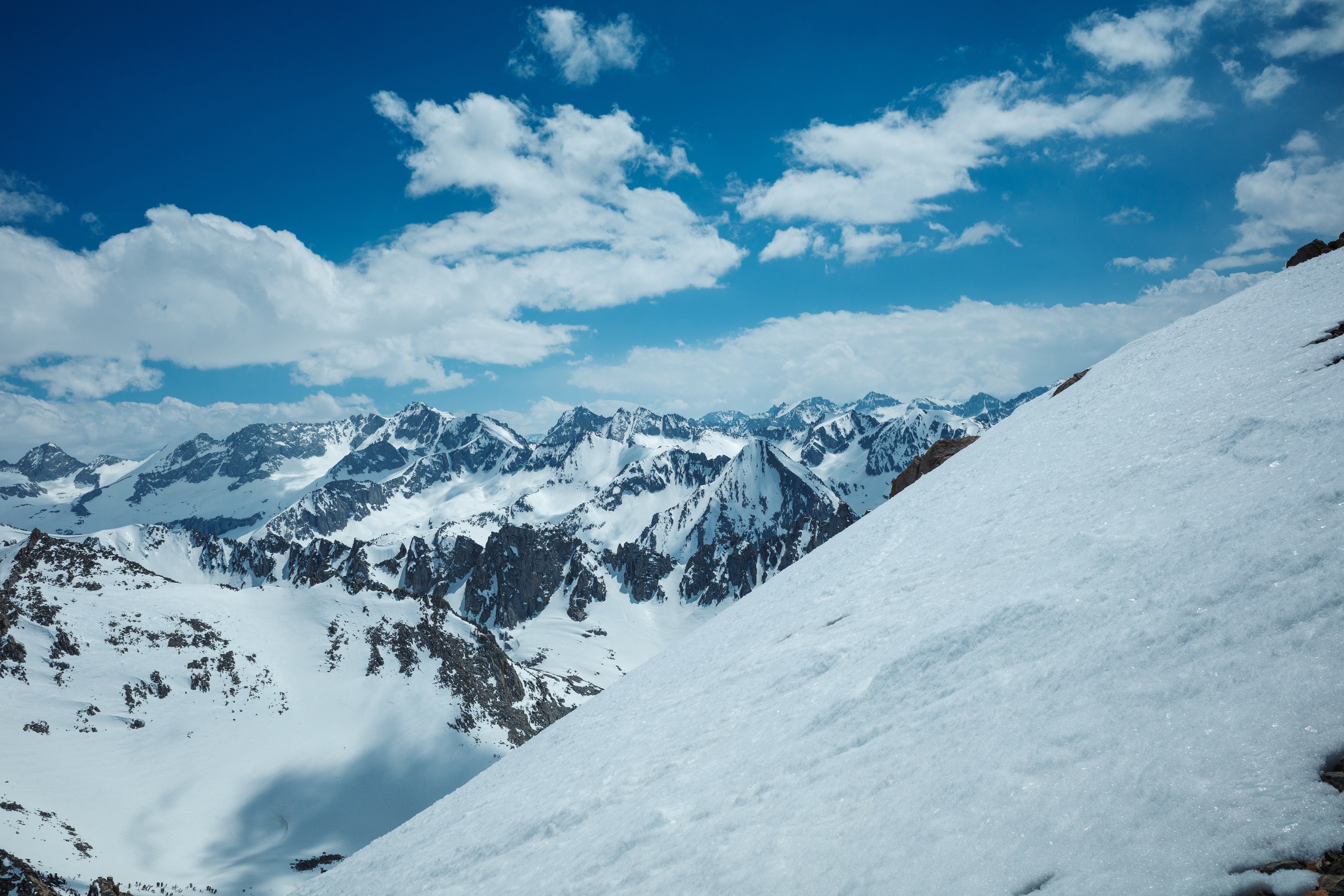
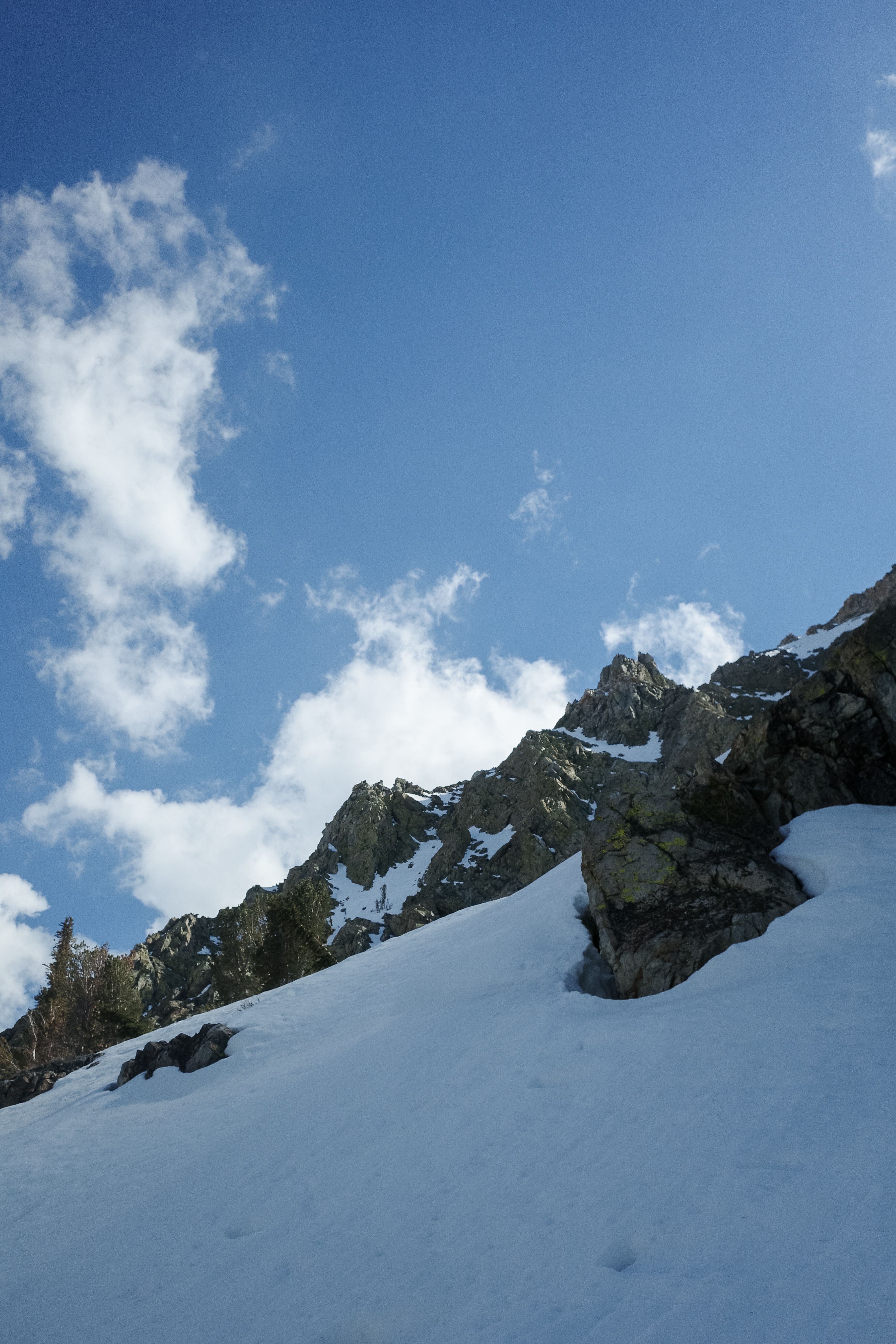
We crest the ridge line running east-west and get our first view of the north aspect. It looks delicious. The summit block is within view, but it requires an exposed class three move to gain. Not something I want to try today in the Scarpas.
so if we aren’t gonna hit the summit block, why do the last 300ft if we can’t get a clear view of if there is a good line?
also the wx was forecast to build, should we take the extra time?
Ari decides to grab the food bag and search for a good spot to place the cache. I post up, kick back, and look out.
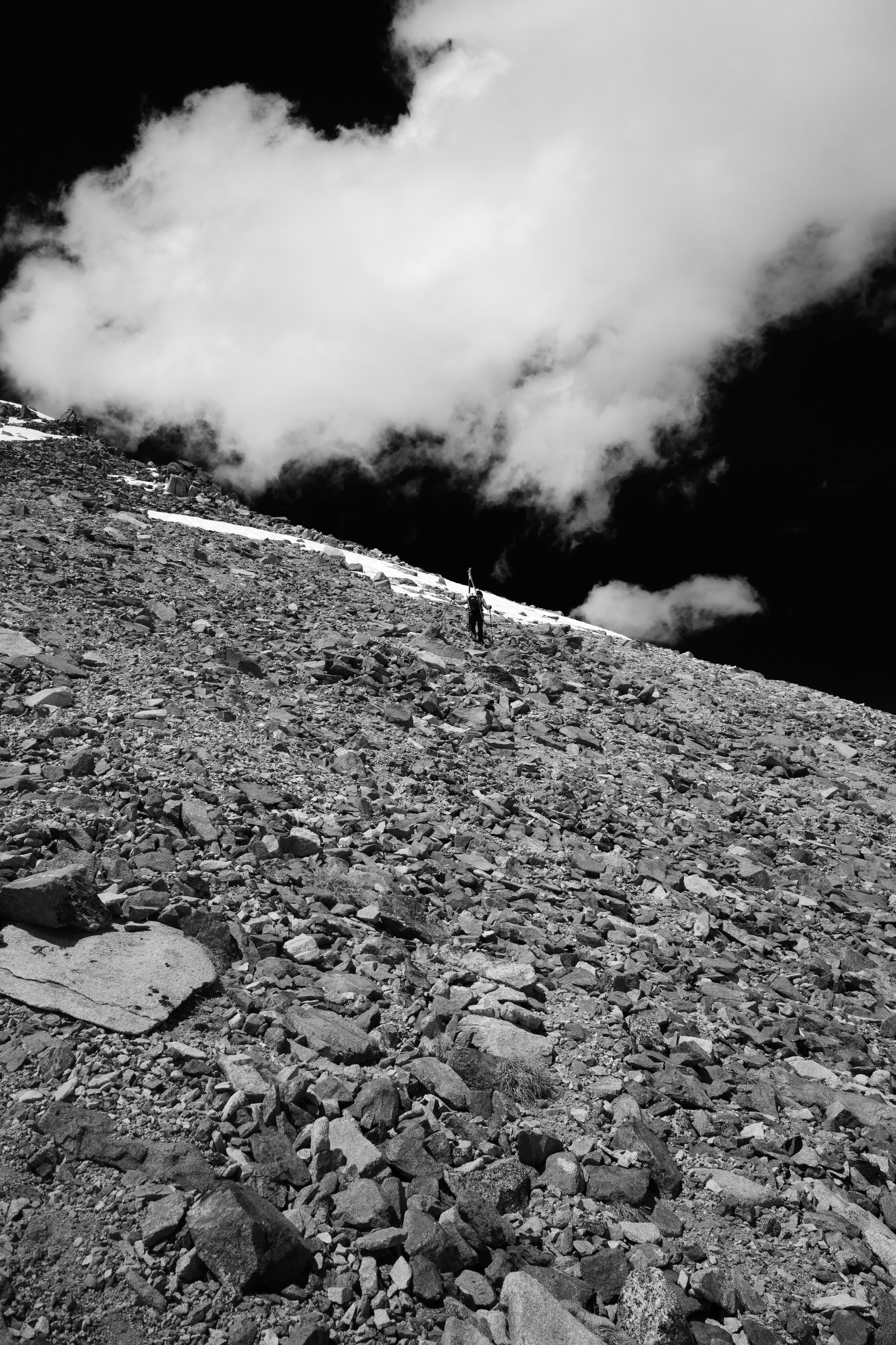
It’s been a while since Ari left, and the weather is building surprisingly fast to the north. She returns to perfectly coincide with my “ok, it’s actually been a minute” reflex as I stand up to stretch the legs.
Skins stashed, heels locked, and ready to rip.
The quality of the snow is decent! Maybe not Michelin Star, but more than enough to satisfying the cravings. Occasional little wet sloughs skim across thin layers of ice creating a very satisfying gritty textural sound. In other areas it’s creamy and dreamy. A fun mix.
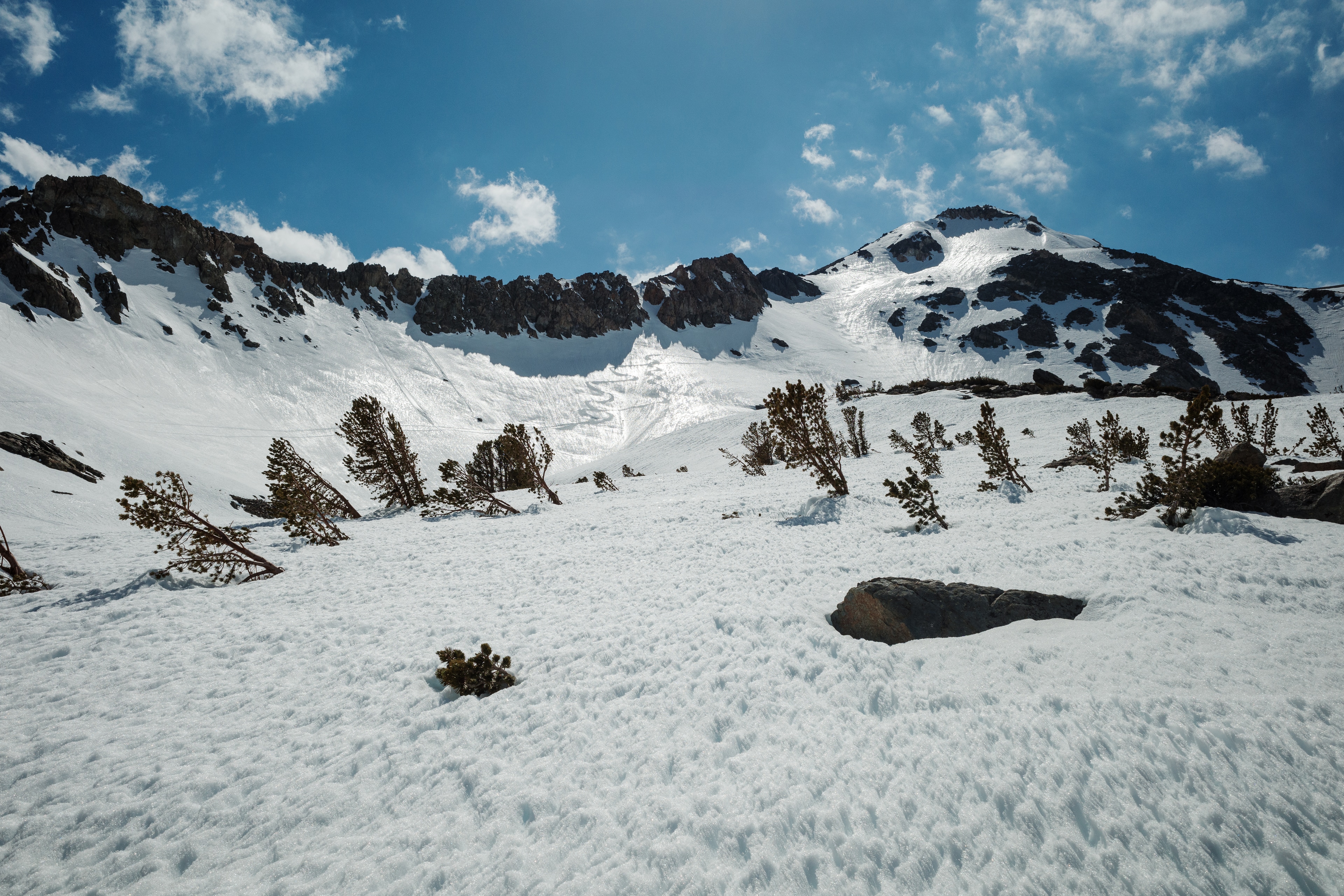
We alternate on the descent until pausing above a frozen auxiliary lake of Golden Trout. Looking in the rear view mirror, our tracks are clearly discernible. The planks sliced clear lines through the thin layer of hyper reflective ice.
Descending the final rollover towards Onion Valley, a couple fresh wet loose slides sweep the southern aspects. The consistency of the snow is turning to mash potatoes. You’ll gain momentum on a slope, then catch whiplash hitting the flats and entering the thick wet stuff. Decent timing, as there’s nothing very consequential—past 30 degrees in slope angle—between here and snowline.
ari is ahead and eking out every last inch of snow before transitioning
like… she just side slipped into what looks like chunky avalanche debris
huge fridge sized blocks of ice lol
ok guess imma do it too
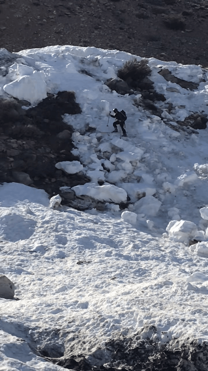
Almost exerted more effort staying on snow to as low an elevation as possible than uphilling to the summit. It begins getting ridiculous, and we transition back to shoes for the road walk down.
Noticed a dirt road that appeared to save us some time. Decided to give it a go, and… it paid off, shaving off a mile or two. Nice.
We arrive back at the gate, a big day and some great turns behind us. Polish it off with ice cream while passing through Independence on the way back north.
Perfect day.