Field Report
A Mammoth Ski Traverse to June
A classic alpine tour along the San Joaquin ridge and down Carson Peak’s north bowl

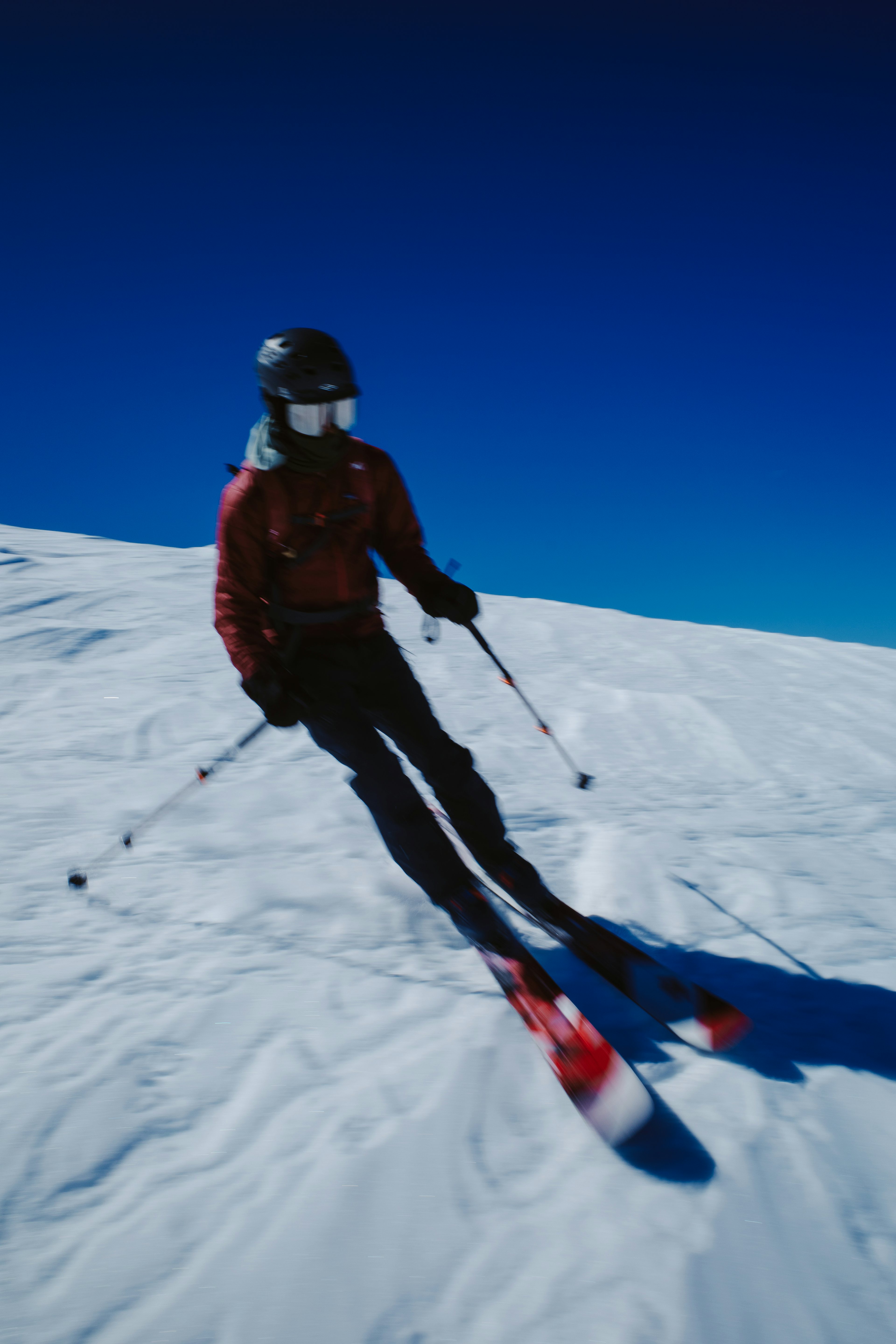
“Alright, 2:45 a.m. See you there.” The weather has been warm, creating an isothermal snowpack by late afternoon. Instead of exhibiting a temperature gradient forming cohesion, the snow becomes a sludgy soup. Unpleasant for skiing, and increasing the risk of wet loose avalanches. Spring skiing is all about chasing good timing.
The Eastern Sierra has an abundance of classic winter alpine traverses. One particular route stands out, as it connects my hometown of June Lake to the nearest town featuring a well-stocked grocery store—Mammoth. Ask any Southern Californian about Mammoth, and they will likely describe it as a premier winter sports destination. Being gratefully spoiled in June Lake with prime lift access to arguably the finest slack-country in America, my thoughts often gravitate toward avocados and kale.
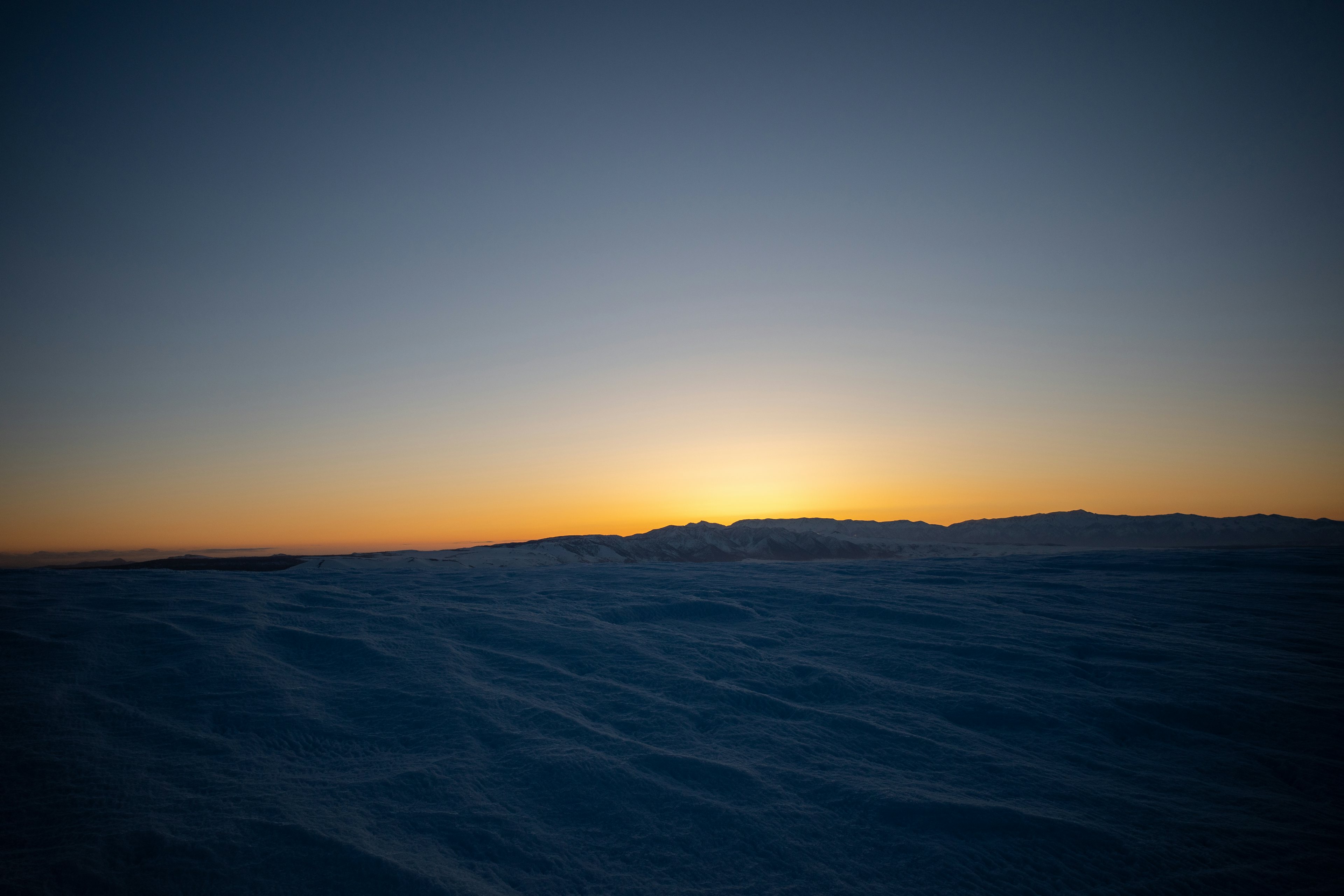
Driving south on the 395 toward the town, the horizon begins to radiate a warm glow. A brilliant orange orb gradually ascends, and though only half-illuminated during its third quarter, it casts striking shadows from the Jeffrey Pine trees.
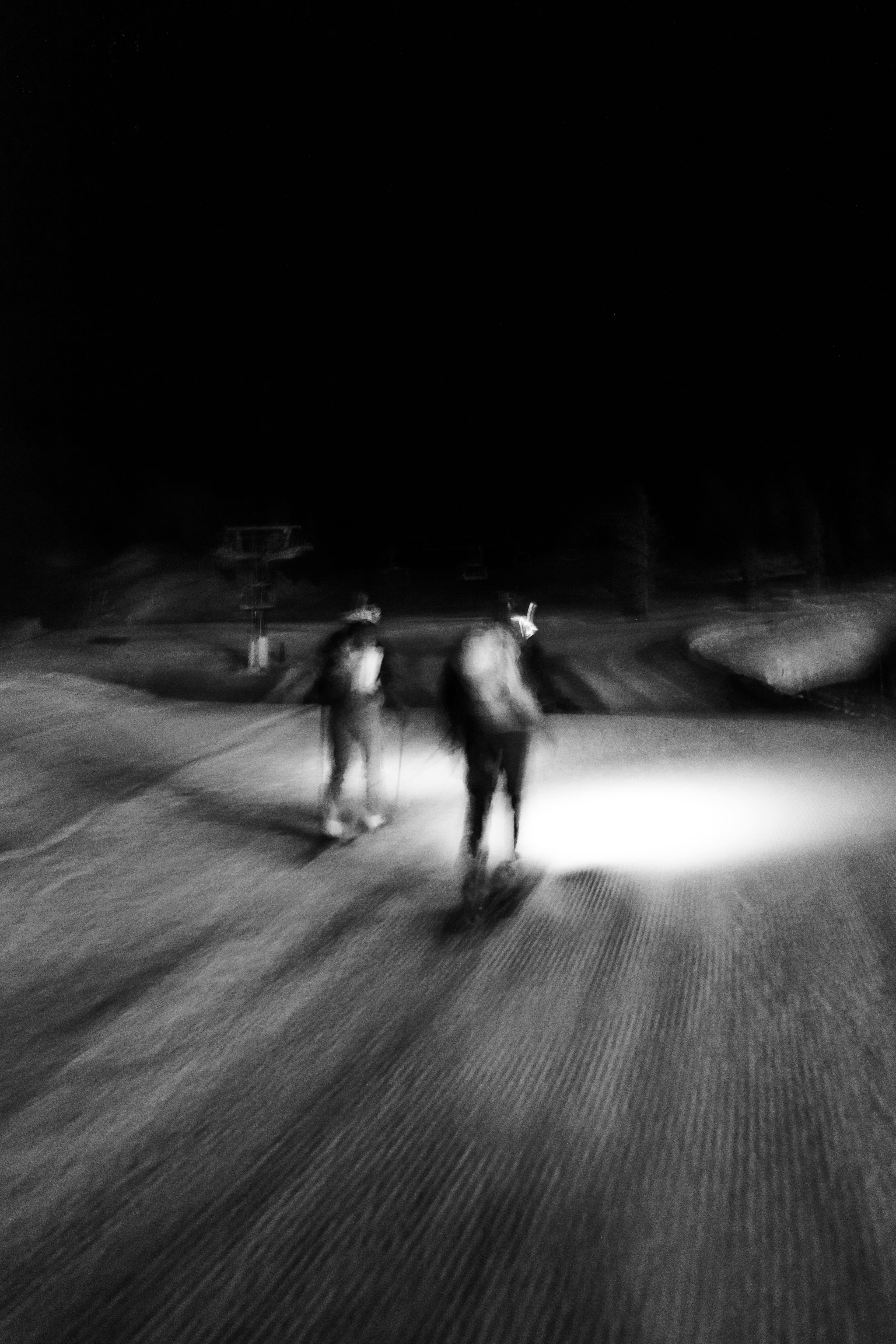
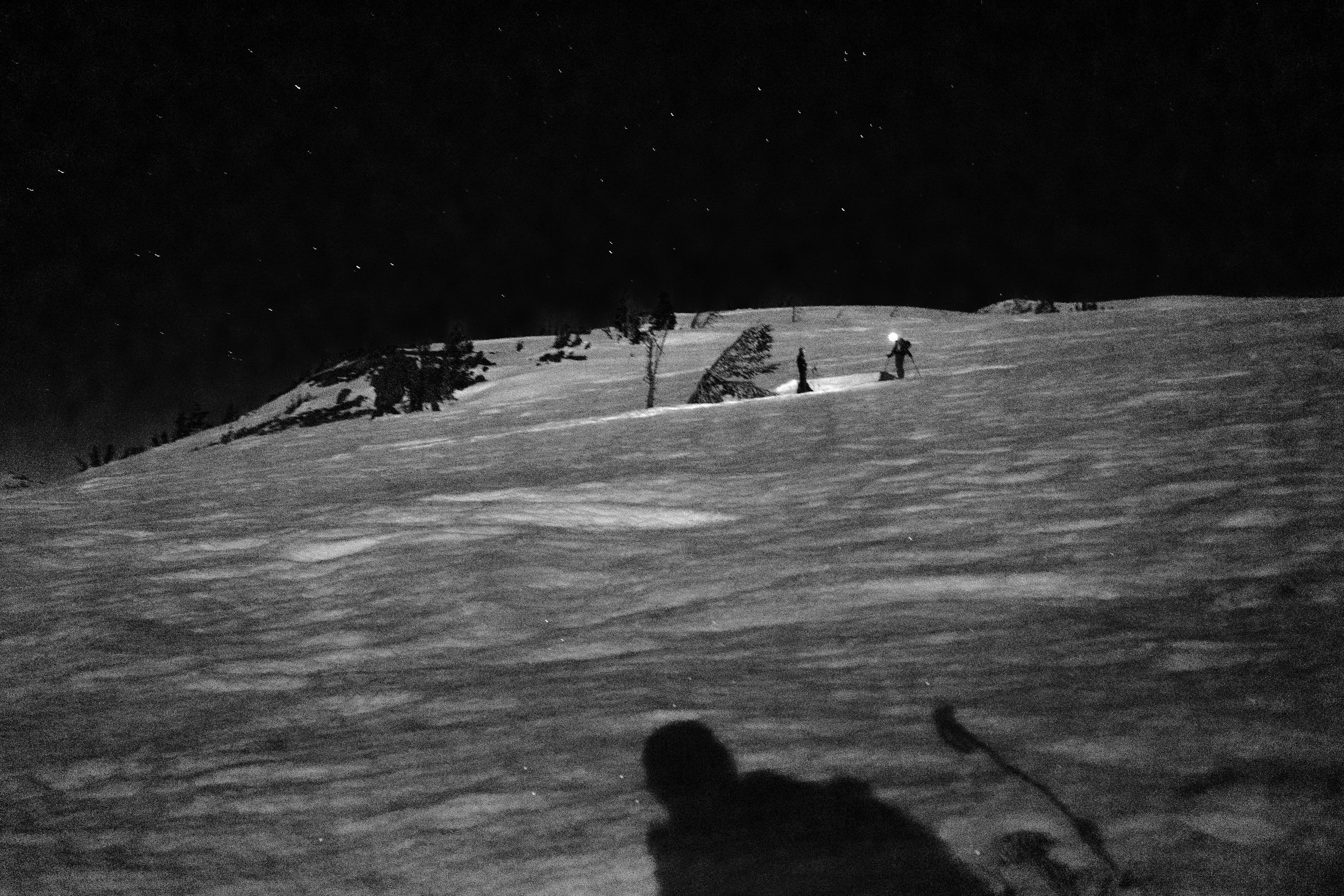
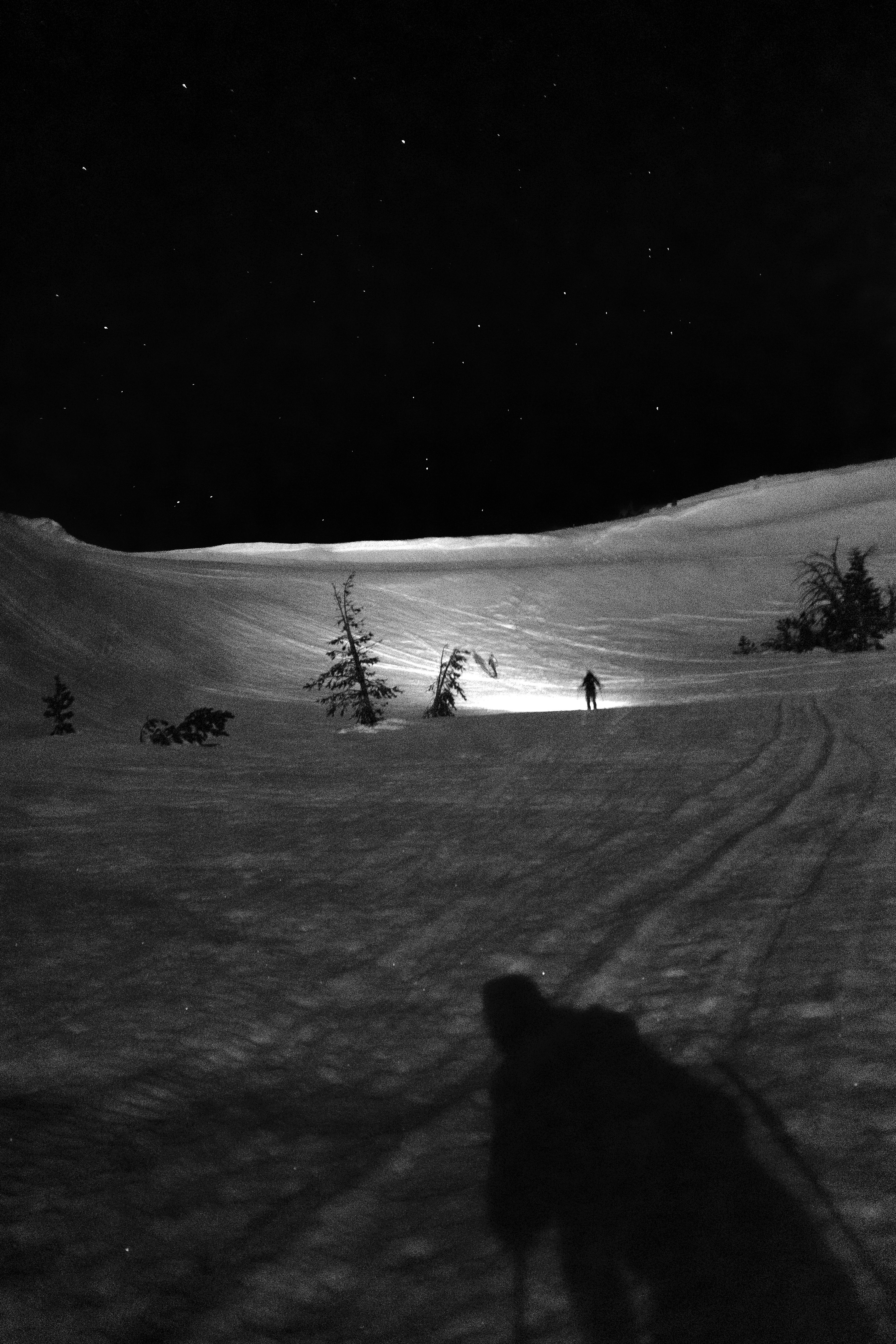
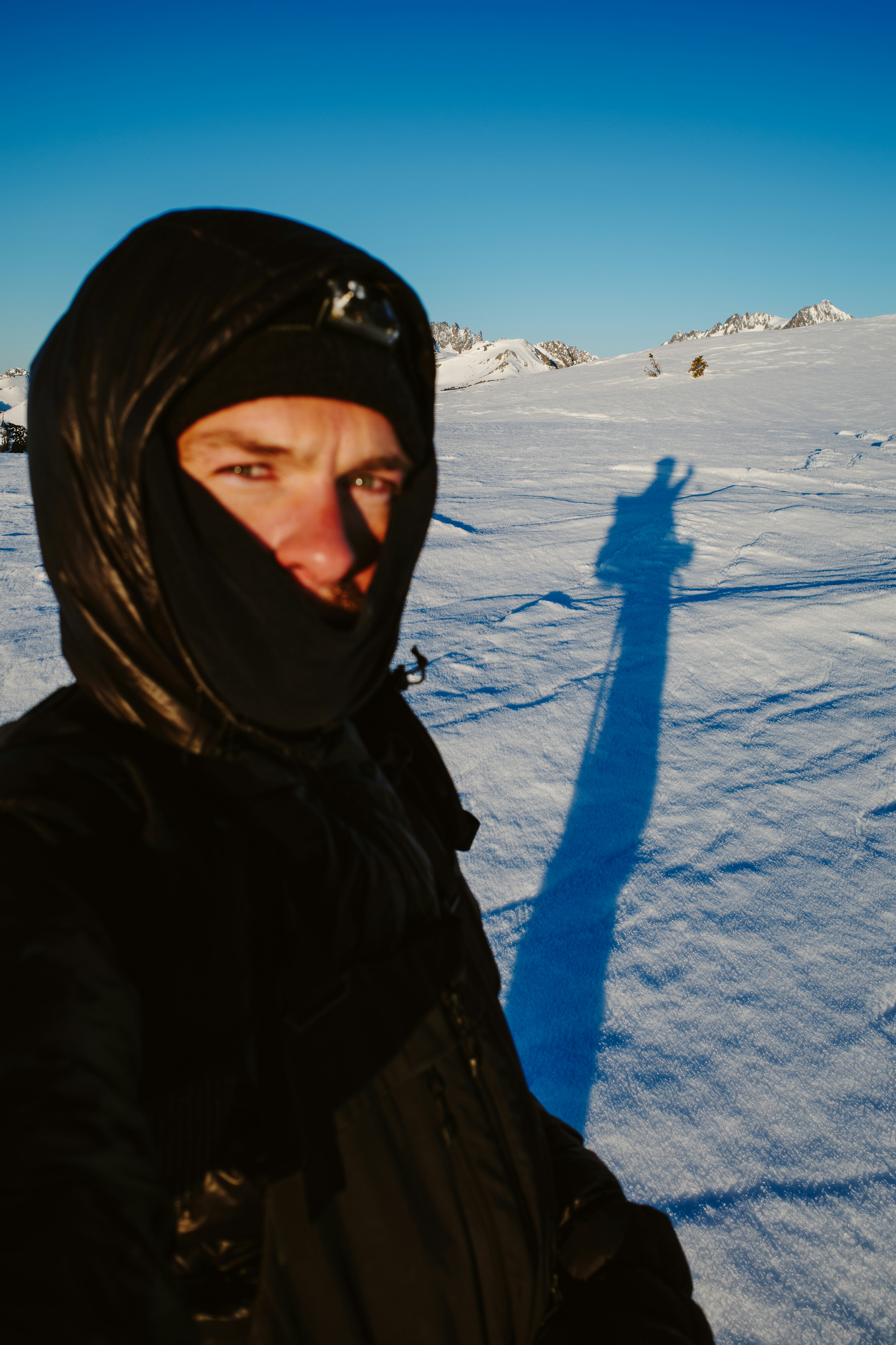
Our designated drop-off location is Mammoth Main Lodge. In a matter of hours, it will be inundated with visitors from the south; however, for the time being, it is solely occupied by us. We swiftly attach the skins to the skis, double-check all the essential gear, and skillfully dodge a snowcat grooming the flat terrain. Only then do we embark on our journey into the darkness at 4 a.m., precisely as planned.
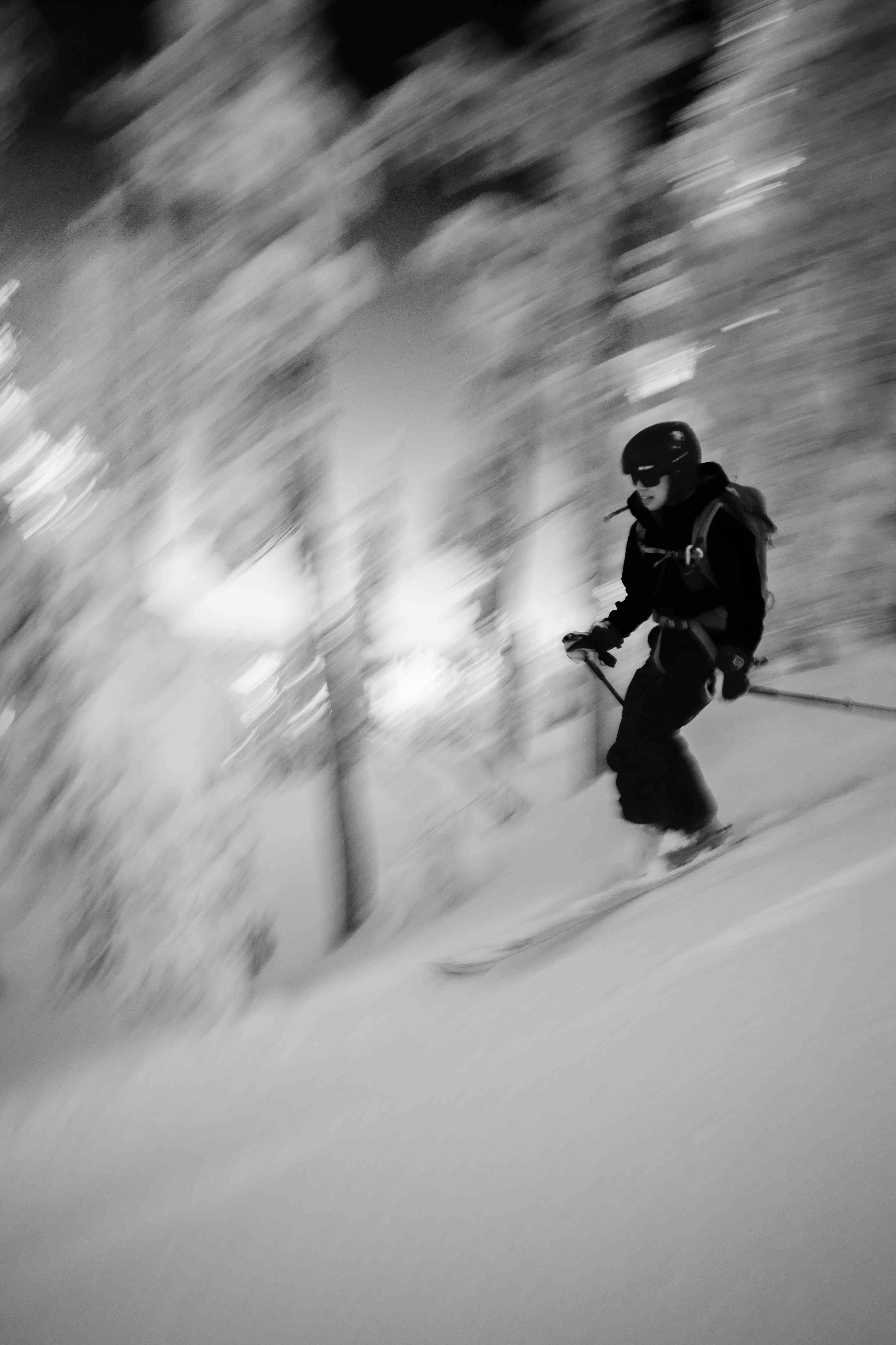
The route traces Minaret Vista Road, leading to a well-visited summertime overlook of the Ansel Adams Wilderness. Our group settles into a steady rhythm, with one foot consistently gliding past the other, reminiscent of socks on a kitchen floor, as toes pivot around ultralight pin bindings. Deep breath. Slide. Turning off the headlamp, we watch the moon rise above the summit of Mammoth Peak.
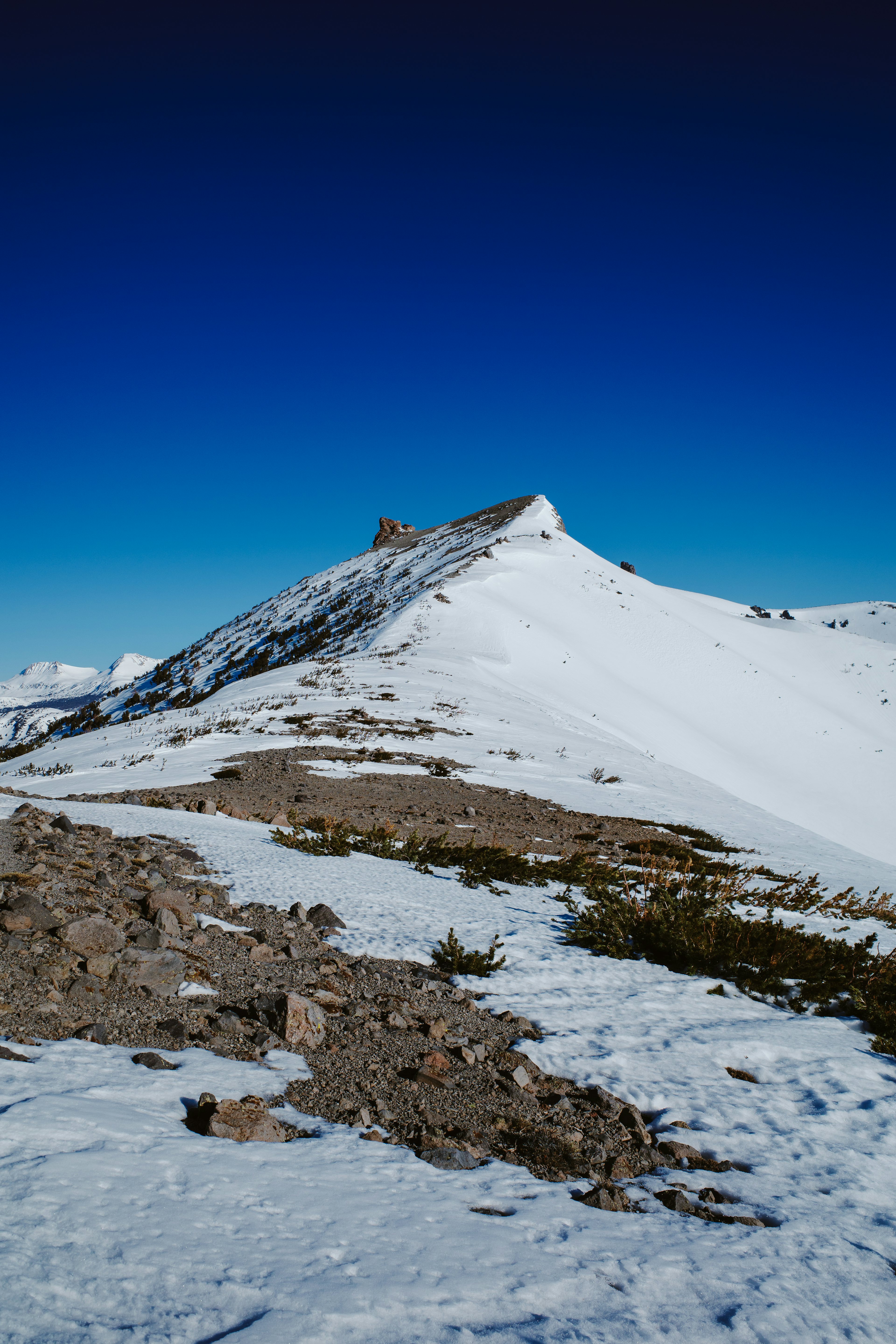
Scarcely any time elapses before we pass the gate leading to Devils Postpile, a striking geological curiosity characterized by columnar-jointed basalt formations. These mostly hexagonal pillars were shaped approximately 100,000 years ago, when lava cooled and fractured—a relatively recent occurrence on a grander scale. Rather than descending to Postpile, the route takes a right turn and begins its ascent along the San Joaquin Ridge.
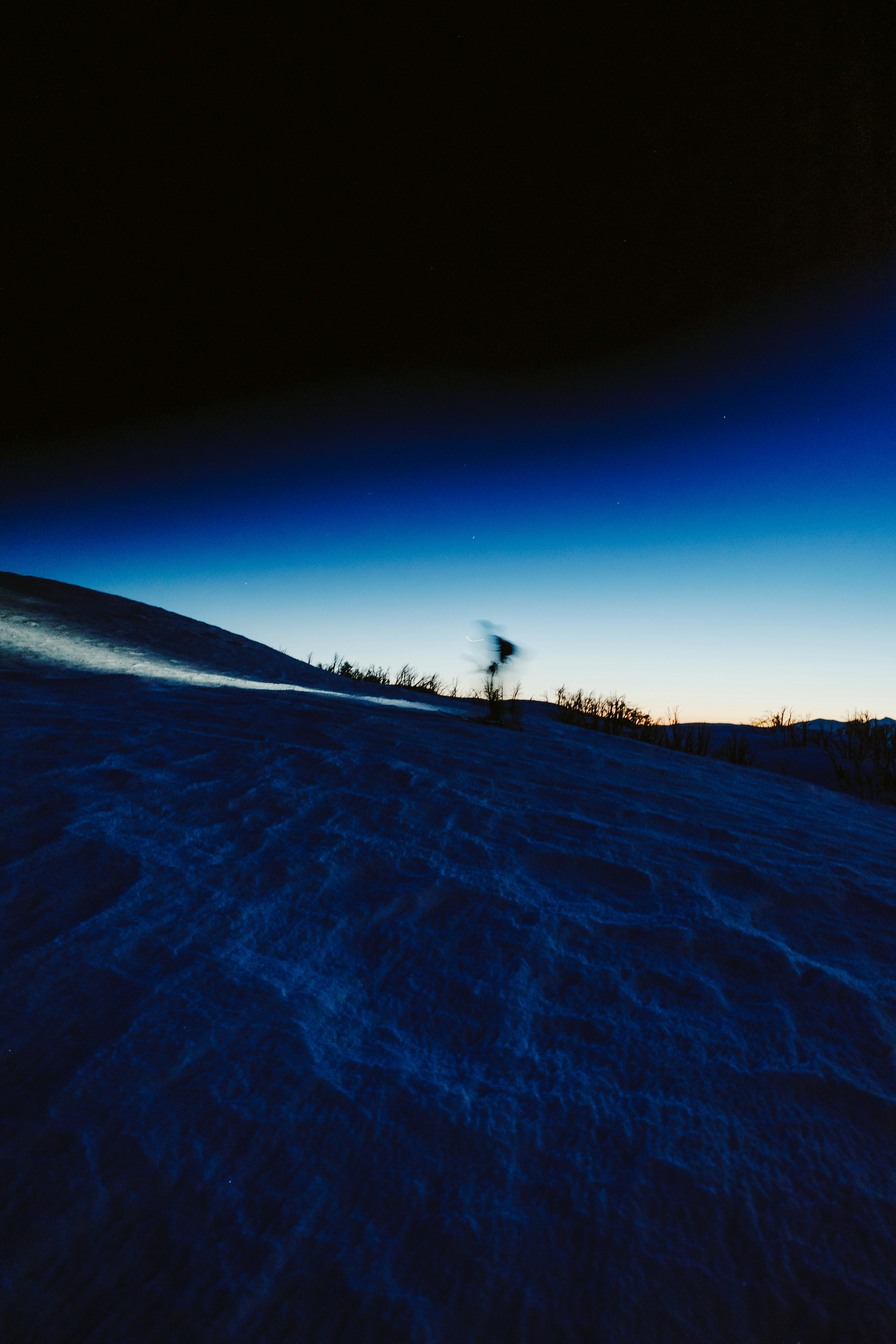
Reside in the Eastern Sierra for an extended period, and the vista of Mount Ritter and Banner Peak becomes a constant, yet it continues to evoke a sense of awe. The unusual abundance of snow this late in the season causes the moonlight to disperse in every direction, magnifying the spectacle. Our group momentarily pauses to absorb the view and settle in to the ridge.
The ridge is infamous for its windy conditions, and due to the Venturi effect, which compresses the air and lowers temperatures, a cold night can become bitterly frigid. This frequently results in the ridge transforming into a sleek ice rink—sufficient reason to carry ski crampons. Fortunately for us, the wind remains tranquil for the time being, as the incline gradually becomes steeper with crampons securely stored.
Approximately two miles into the journey, we find ourselves fully immersed in the experience. However, our focus is momentarily disrupted by something reflecting the moonlight in our peripheral vision, only for it to vanish abruptly. We feel as though we are being watched, and then a pair of eyes materializes. A coyote dashes past us and lingers up ahead, seemingly curious about one aspect or another. It must be hungry, as this winter has been particularly challenging.
As the ridge grows increasingly exposed, the wind intensifies. The cold sets in, prompting us to grab the mitts. Glancing upward, we notice a faint dot gradually brightening as it steadily moves across the sky, its azimuth passing directly overhead before continuing toward the horizon. “Look, a satellite!” In just a few moments, another one appears, followed by yet another, and then another. An entire procession of Starlink satellites travel at a consistent speed in a perfectly straight line. Observing human intervention on such a planetary scale in this setting creates a truly hyper-real experience.
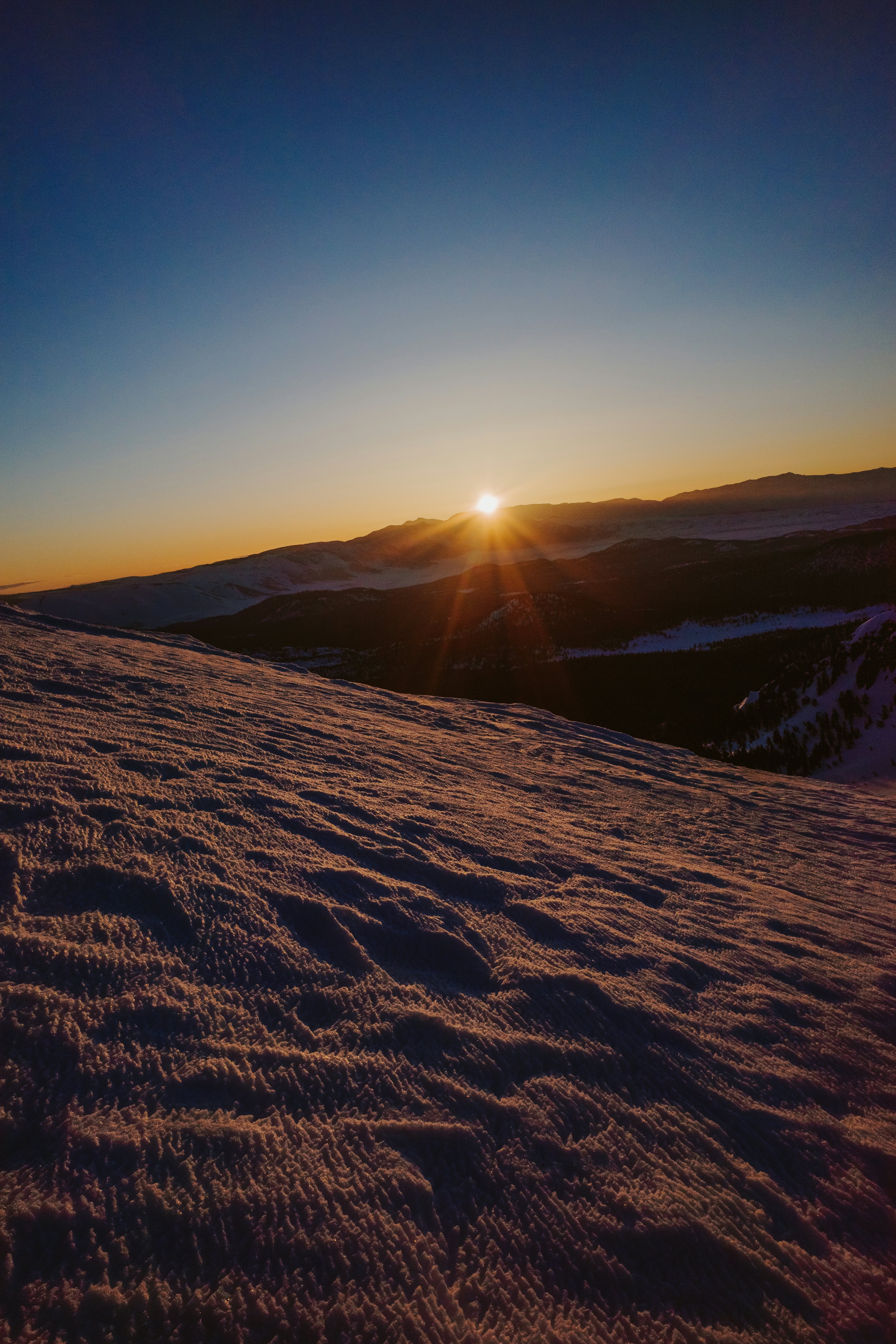
To the east, above the White Mountains, a faint glow starts to spread across the horizon. This sight is undoubtedly welcome. The silhouette of the coyote appears, maintaining pace with us, most likely eager for a morsel from a Snickers bar.
Up ahead, the ridge dips no more than a few hundred feet to a corniced saddle. Removing skins would be an inconvenience, as there are no turns to be had here. Instead, our group begins side-skinning downhill. After a couple minutes, Nick pivots and straight-lines it down the remaining half! I have never seen anyone move downhill fast on skins! The flat dawn light conceals the wind-sculpted sastrugi at the base of the saddle, causing Nick to go flying, toes locked and all. With broken glasses, blood, and a grin on his face, we are all slightly stunned and laughing.
Speed record? Likely!
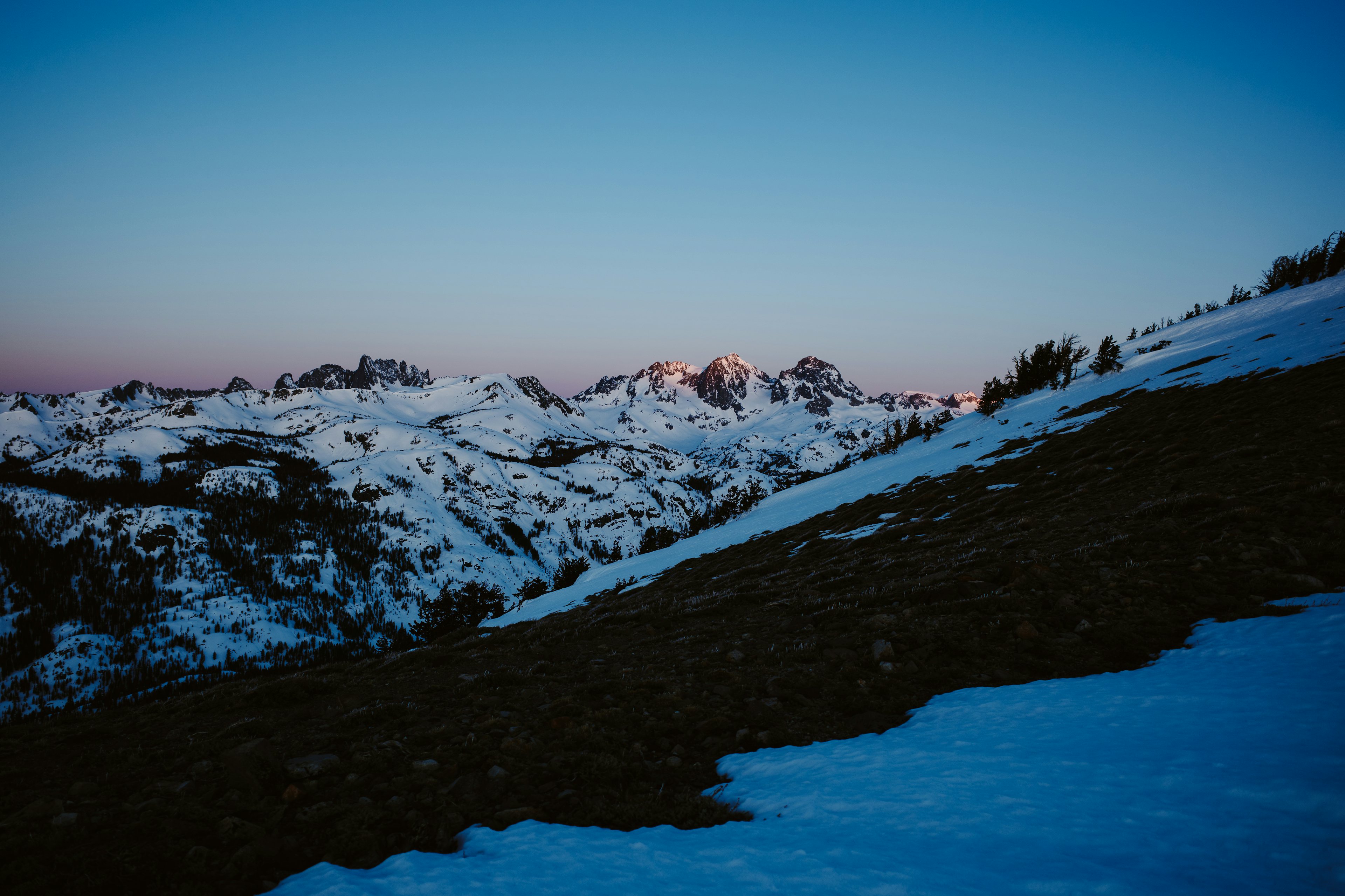
The day’s first direct sunlight illuminates Ritter and Banner in the distance, then the ridge ahead as it continues its ascent. The temperature rises a few degrees, prompting the group to pause and take in the view, warmth, a few sips of water, and a snack. Nick seizes the opportunity to insert the remnants of his glasses into his goggles to keep everything intact. Meanwhile, Agnew Pass, situated to the east, gradually fills with sunlight.
When attempting to describe these moments, I find myself reaching for phrases like “unreal” or “another planet.” It's ironic, considering they are often the most real and entirely unique to our home planet.
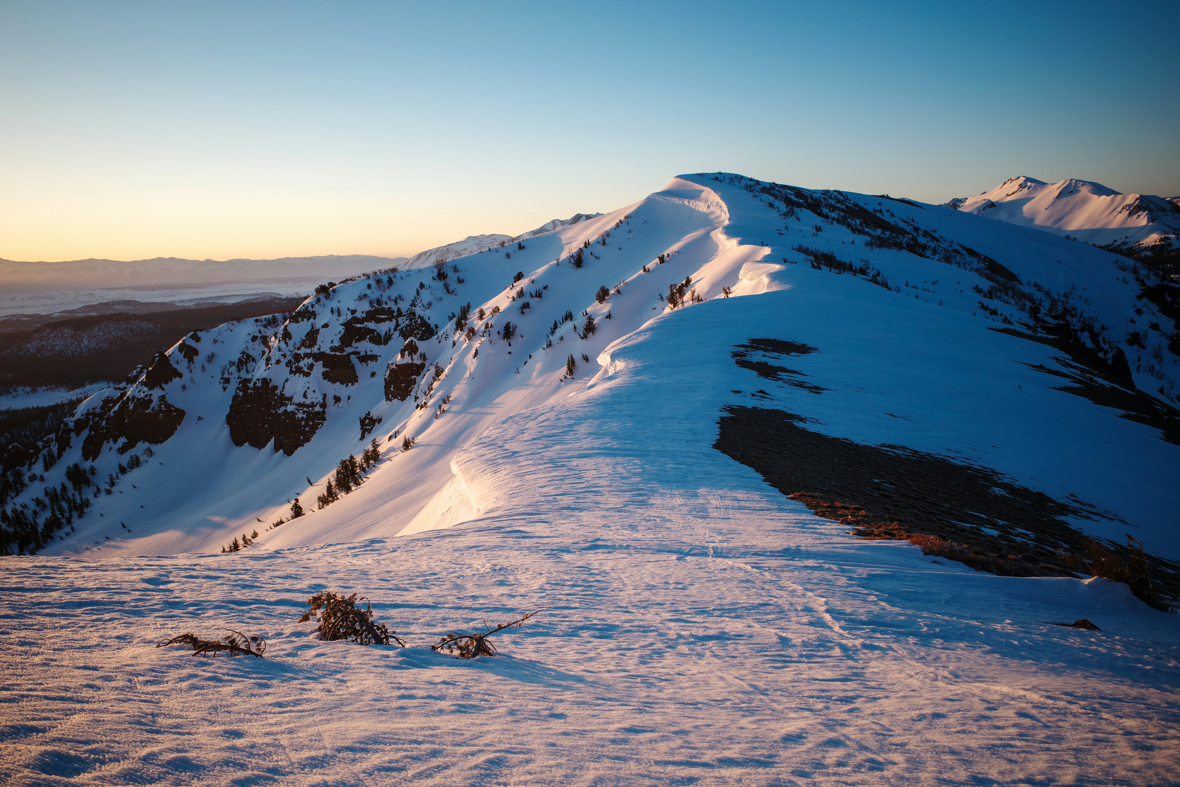
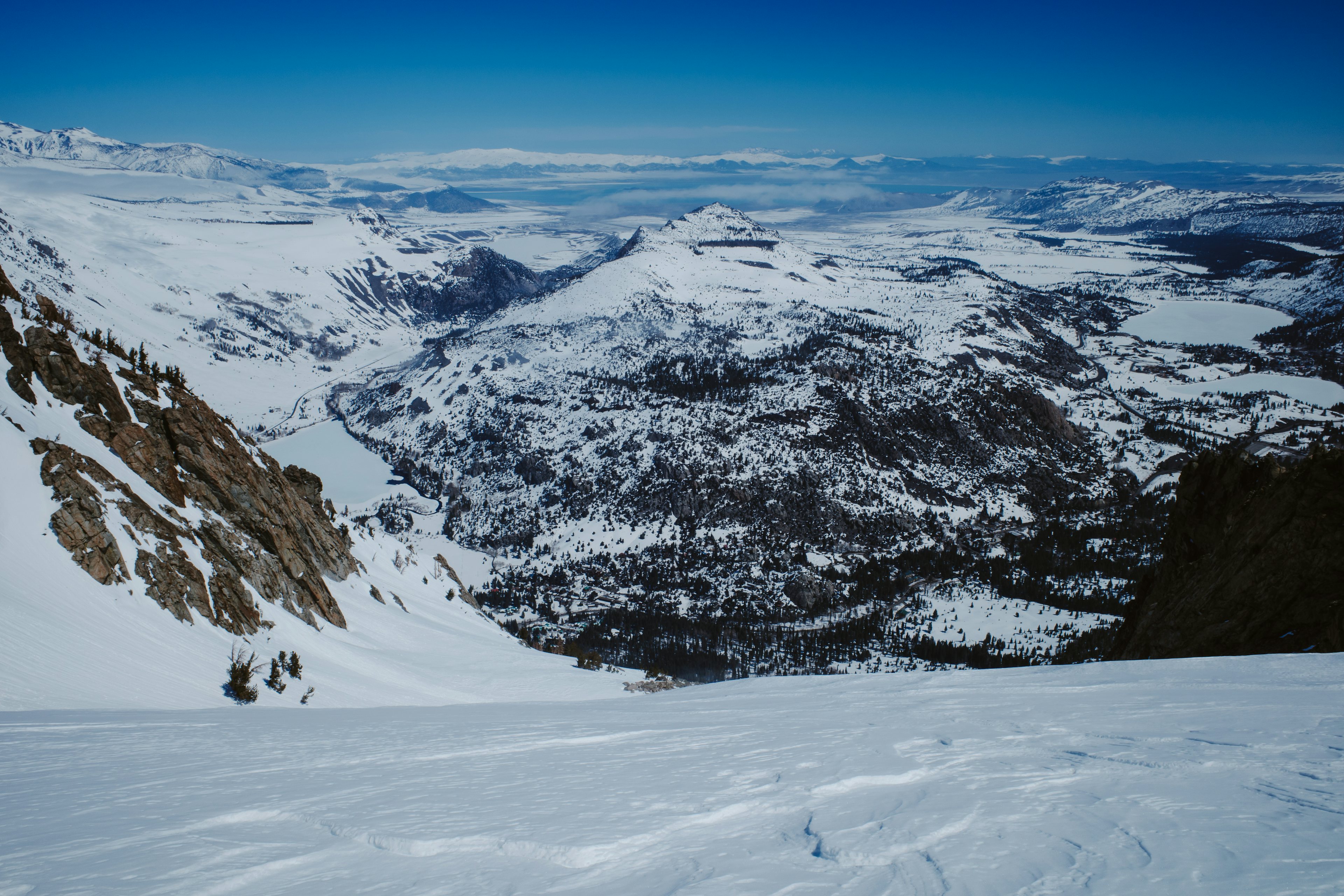
This ridge was once slated to become part of a mega-resort, connecting the Mammoth and June ski areas with a series of nearly 20 lifts. These plans were discussed for decades, until Congress designated the area as the Owens River Headwaters Wilderness under the Omnibus Public Land Management Act of 2009—a decision I’m grateful of. It’s a reminder of the interconnectedness of things. This drainage system, feeding the same Owens water supply that has long provided Los Angeles with water.
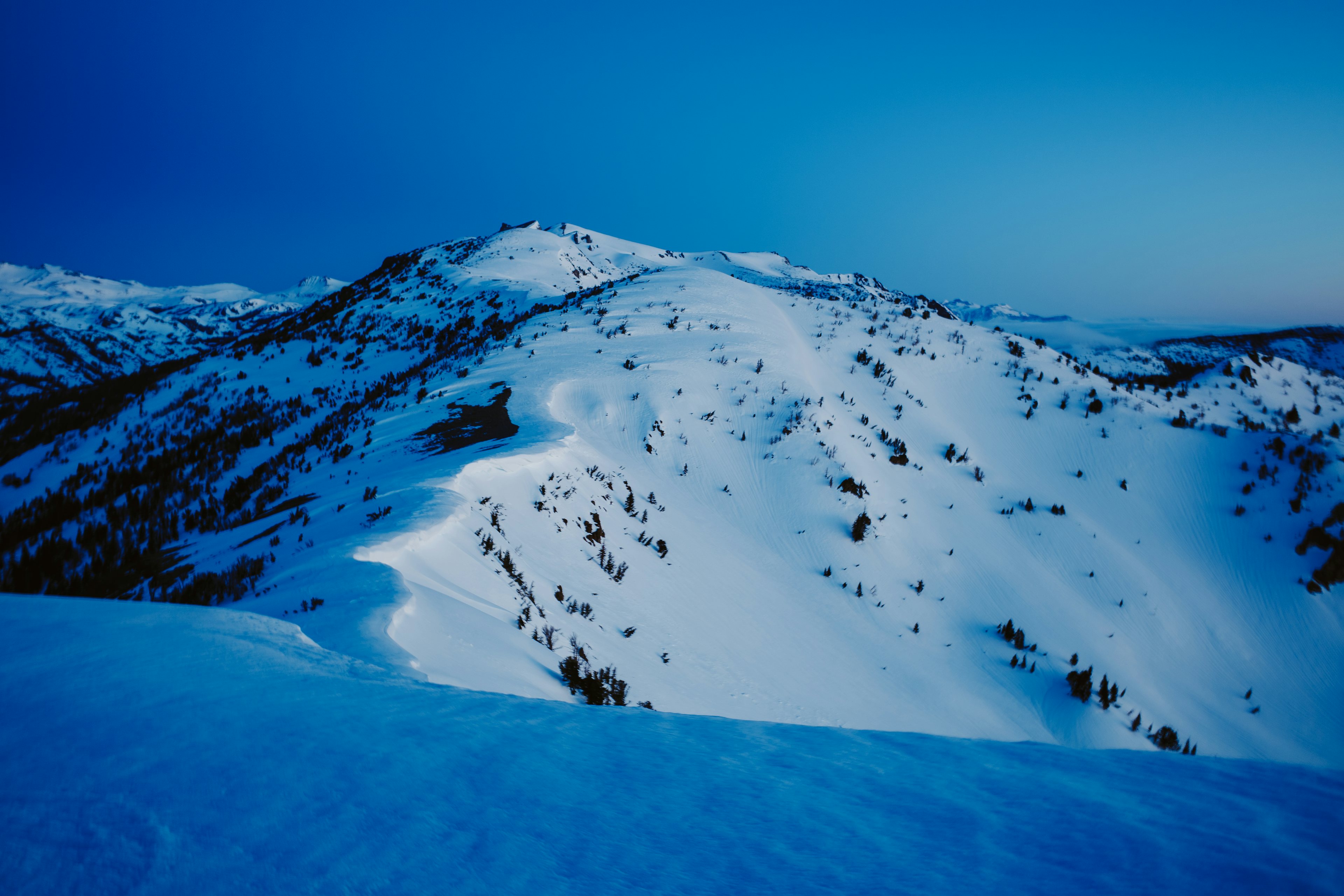
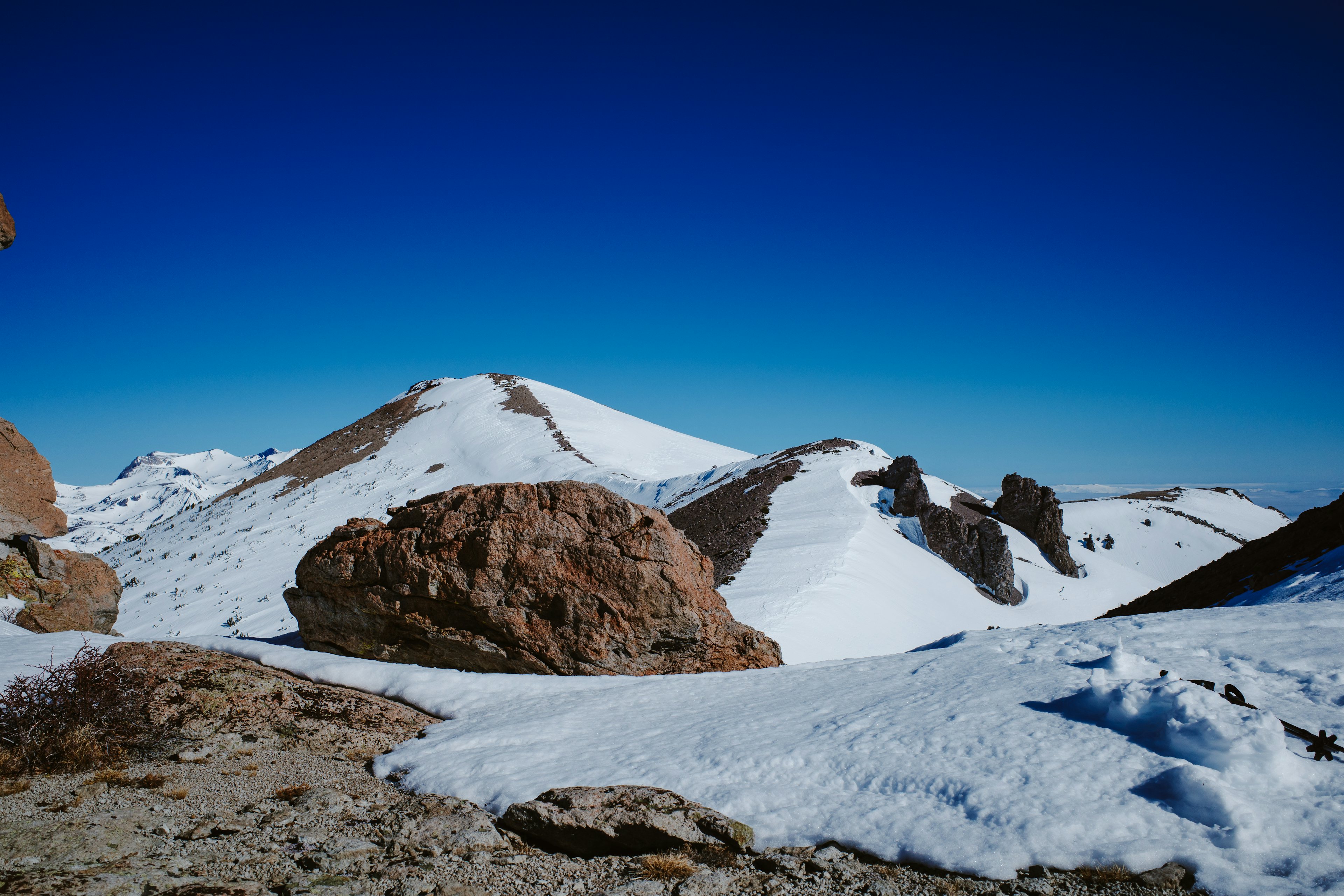
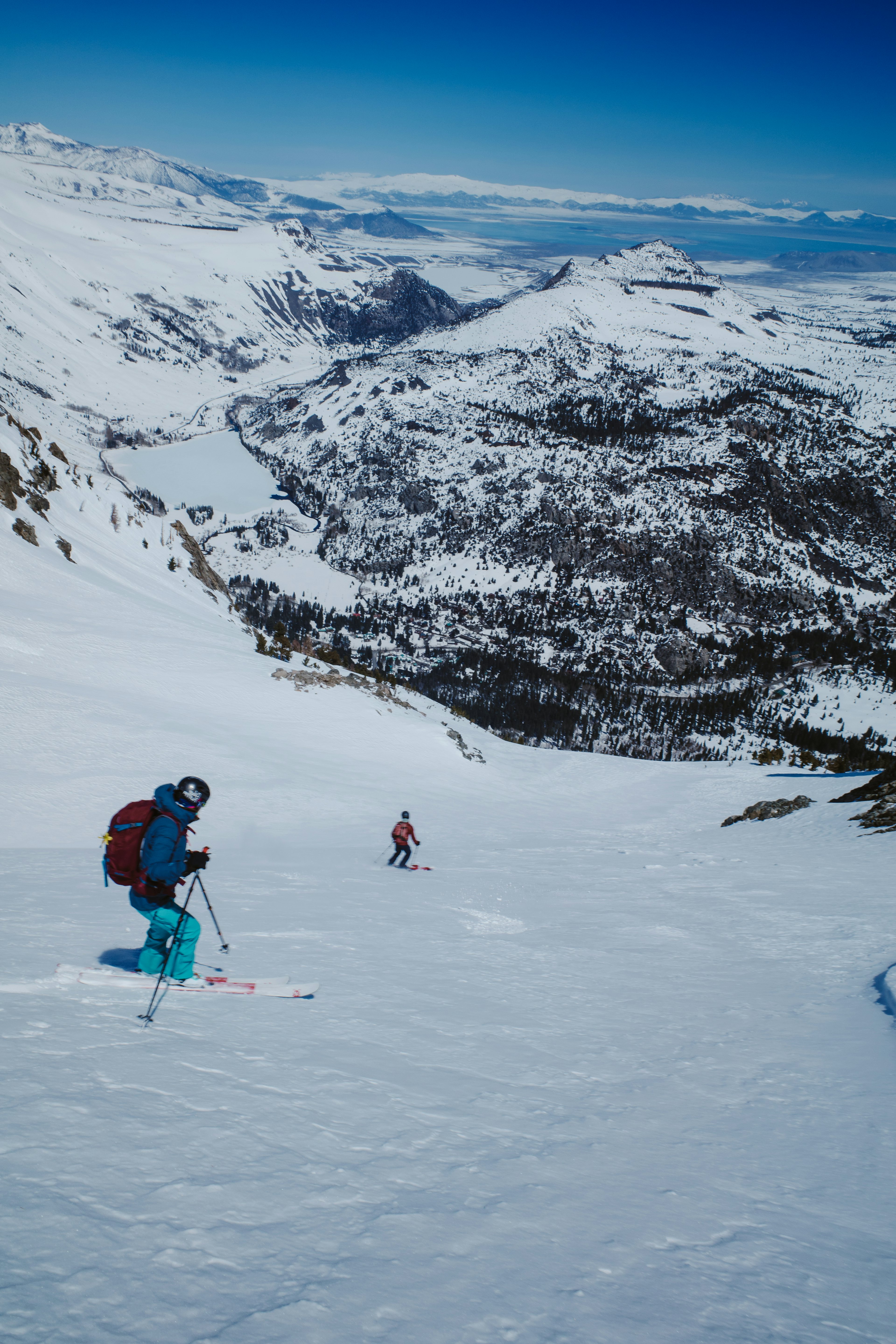
As we reach the top of the climb, our first view of “Two Teats” comes into focus. It’s easy to guess the general area referred to here. Yeah—we intend to navigate right between them. When looking back at the distance covered, it’s evident we’ve made good progress. We’re now more than halfway there.
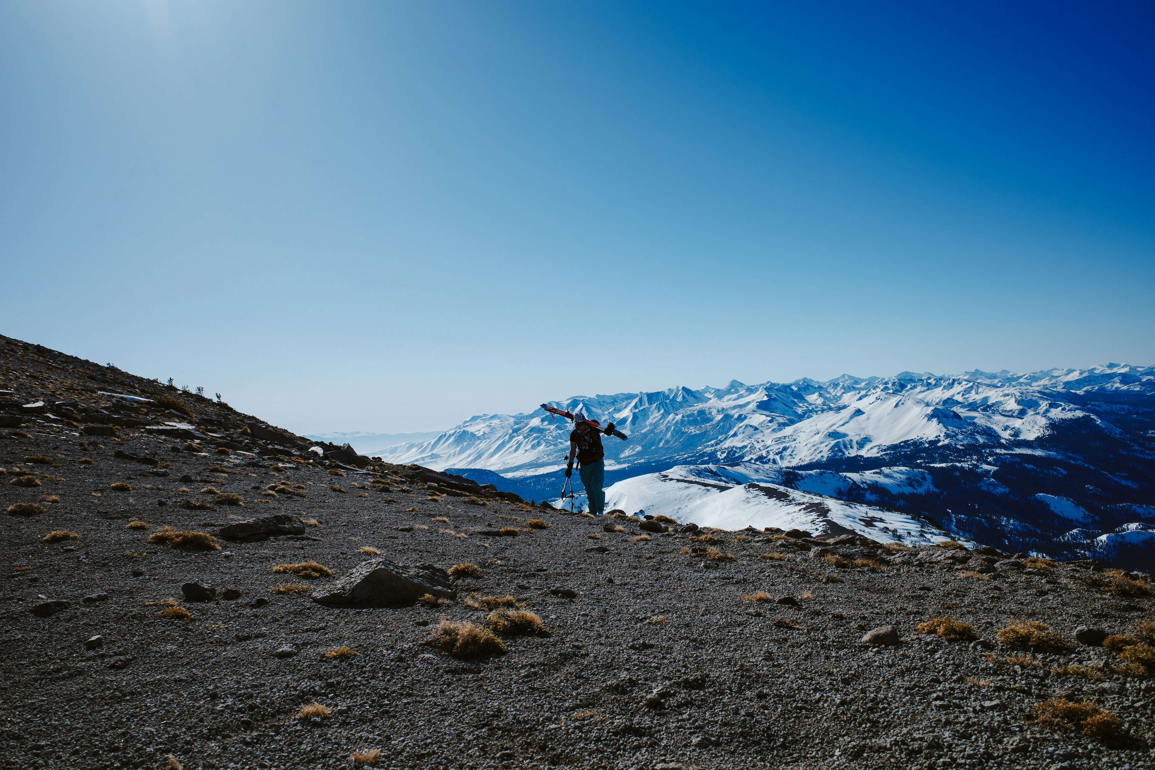
Over the past week, there has been significant solar activity, as springtime tries breaking through. Bald patches of ground appear on the climb ahead, and surprisingly, for a moment, an actual dirt trail becomes visible—the first of the season. But for now, it’s very much still winter. As the incline steepens and the snow hardens, the ski crampons come on, just incase.
It ends up being mild, and before long the planks come off and the group starts booting up gravel. This provides a pleasant change of pace after months of sliding around.
Upon reaching the saddle between The Teats, our first view of San Joaquin Peak comes into sight. The sunlight, now noticeably stronger, gently invites us to take a break in this sheltered alcove, and we are eager to oblige.
With feet propped up, the group discusses various exit strategies. Numerous routes lie ahead, and given the cold temperatures and stable snow, we decide to pursue a more ambitious option.
As you drive into June Lake along the 158, your gaze is immediately drawn to Carson Peak and settles directly on its north face, featuring a perfectly carved bowl—the very bowl we decide to ski. Having been a primary objective since moving to June, I am incredibly eager to drop in.
As we descend from The Teats, looking back reveals an impressive headwall. There are countless potential routes, and everyone agrees to return at a future date for further exploration. The final ascent to the summit begins, with some members of the group choosing to hike, while I decide to practice my kick-turns.
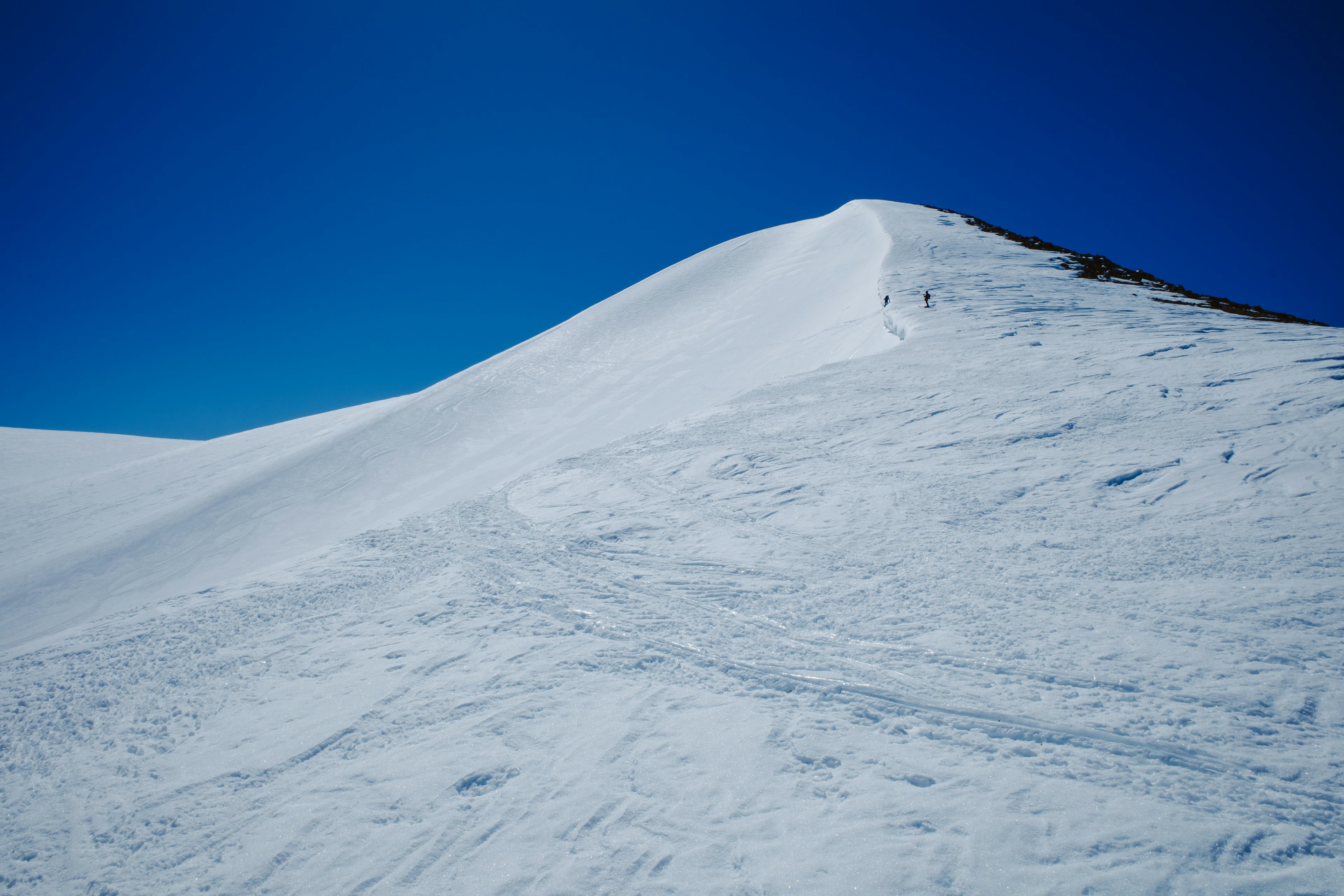
In no time, the summit is reached. This is my third visit within the past few weeks, and the view never loses its charm. We take it all in. With no real rush, we slowly remove our skins, transitioning between relaxation and preparation for a brief downhill traverse to Carson.
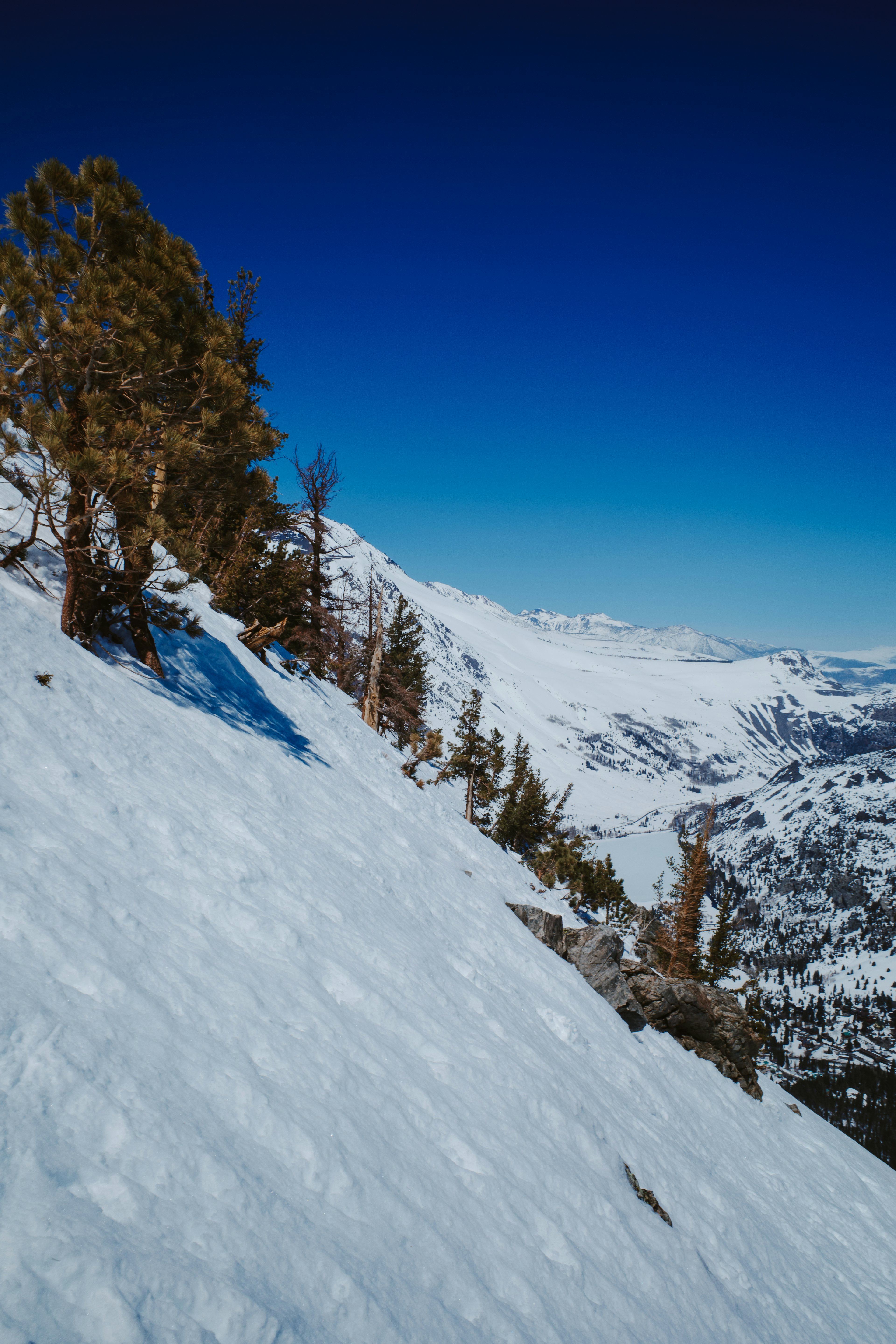
As the group traverses a bowl beneath San Joaquin, we ascend and cross a cornice to follow its lip toward a plateau leading to Carson. During the summer, I jogged along this same route towards Spooky Meadow after a big climb to the summit via Fern drainage. I remember thinking "whoa nelly” and imagining how incredible it would be to glide through here on skis. What took me 30 minutes to jog now takes only minutes to slide across. Winter travel has its perks.
Sufficient uphill terrain between our current location and the drop for Carson's north bowl warrants skinning up. A large white hare darts across the alpine tundra—an incredible sight! This ascent feels more like a leisurely cruise, with the mind drifting on the gentle breeze.
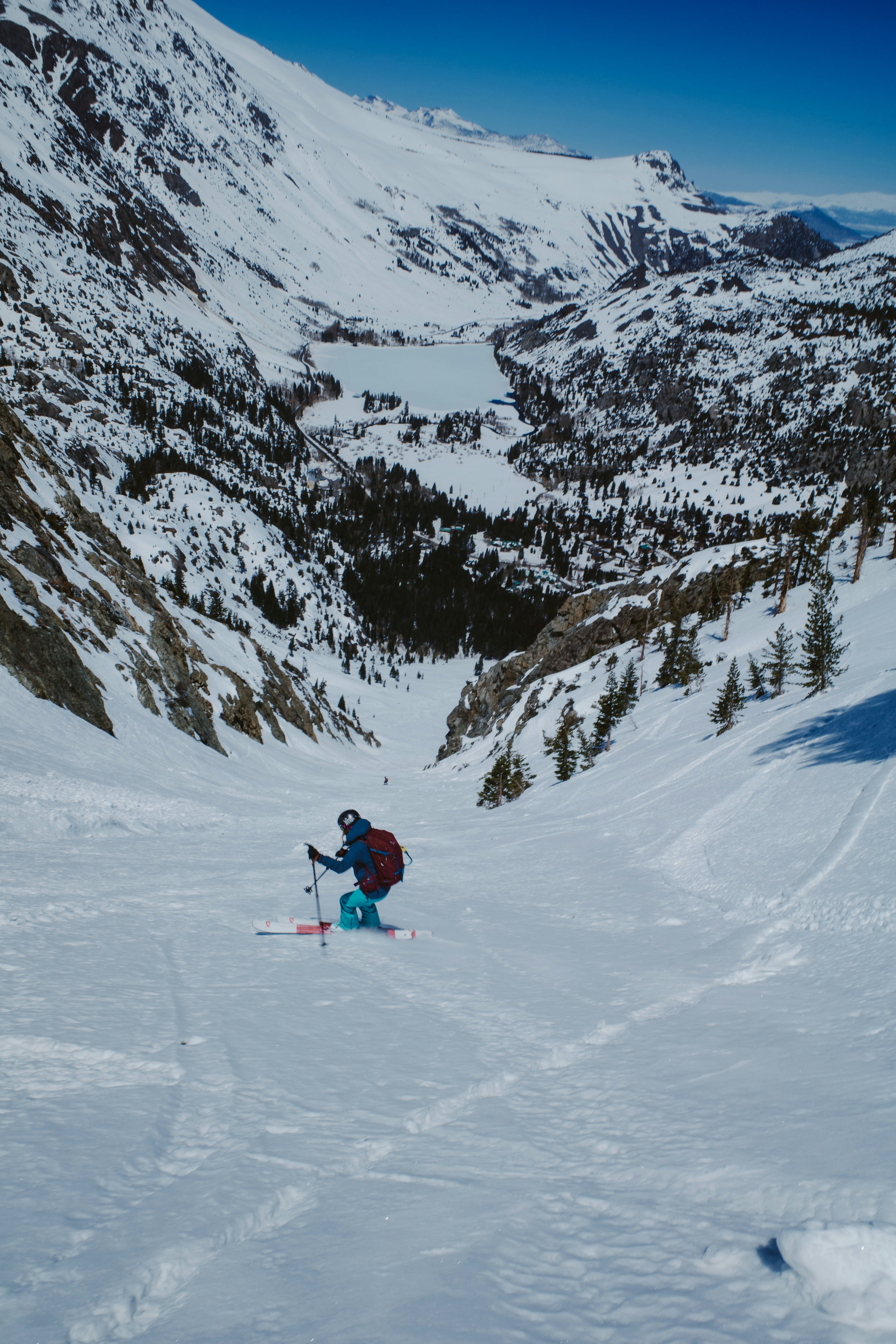
Upon reaching the top of the bowl, a perfectly symmetrical view of the June Lake Loop emerges, with Carson dividing the two halves. “Wow... Wow…” From this vantage point, it's impossible to see beyond the rollover and fully observe a route down the bowl. The snow is surprisingly firm, probably due to the strong wind from the previous evening and the subsequent low temperatures. Consequently, the group boots around, examining the area.
We agree to drop towards the right side of the bowl. After chatting with a friend who skied the line last week, we know that the exit is through some trees on the right. The bottom of the bowl cliffs out, and the firm snow means that falling is risky. Our plan is to link up with Devil's Slide—a feature so filled in during this record snow year that it’s like a halfpipe with a 2000 foot descent.
After waiting for the better part of half an hour, it becomes apparent that the snow is not softening beyond its present condition. Nevertheless, it is edge-able, and we decide to drop.
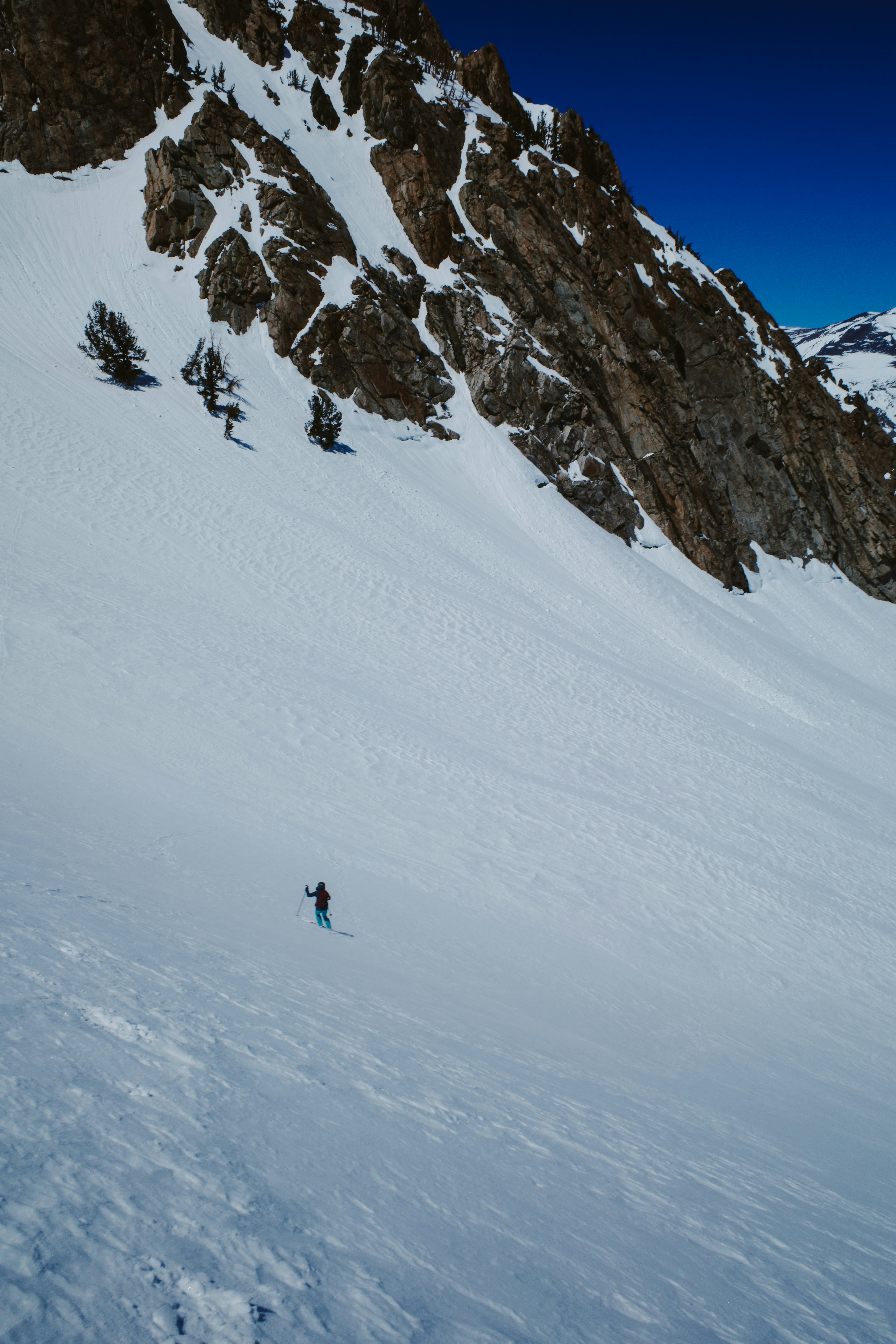
Despite the firm conditions, skiing down the bowl is too good to pass up. Being here, skiing a line I've stared at so many times, fills me with immense joy and pride, even though it may not be the biggest or most exceptional by any metrics. “Here I am!”
After reaching the bottom of the bowl and above the cliff exposure, we begin our traverse through the trees towards Fern Lake. We make a few corrections along the way since the group is initially higher than necessary, but before long we pick our way through the trees and rocks to arrive at the top of Devil's Slide.
Skiing down the slide has become almost routine for me, as this is my third time here in the past few weeks. Still, the descent never gets old. The heat of the past few days has deposited debris from several loose wet slides throughout the descent that have now firmed up and made for somewhat technical skiing. Nevertheless, we ski with all smiles the entire way down.
Reaching the runout, the group ducks into a notch in the trees and zips the flats towards my car, having staged it there several hours earlier. A series of creeks run through this zone, and the snow bridges that existed only days earlier have now collapsed. We carefully pick our way up and over a berm for a brief walk back to the car.
It was a personally monumental day, and completing the long standing objective was satisfying. I have a sierra-sized amount of gratitude to Nick and Kim for letting me link up for the tour.
In the eastern Sierra, the places are second only to the people.